Romeoville night lights from space
Night Light of Romeoville (Illinois) from space (United States) Src. Average luminocity for 10x10km area is 89.211% and for 50x50km: 72.5003%.
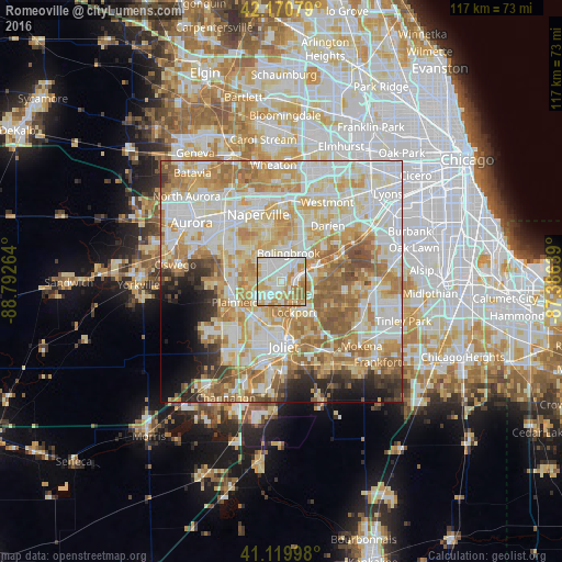
Analysis of Romeoville night lights 2016
Square area 10x10 km:
 28.25%
90-99
31.98%80-89
13.31%70-79
15.1%60-69
11.36%50-59
0%40-49
0%30-39
0%20-29
0%10-19
0%0-9
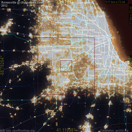
0%Square area 50x50 km:
17.84%90-99
19.23%80-89
13.39%70-79
12.71%60-69
11.63%50-59
7.04%40-49
2.91%30-39
2.71%20-29
3.72%10-19
4.2%0-9
4.63%Clear (daylight) street map image can be seen on geolist.org.
Map coordinates:
42° 10' 14.8" North, 88° 47' 33.5" West
41° 38' 51.1" North, 88° 5' 22.2" West
41° 7' 11.9" North, 87° 23' 11" West
Some cities around Romeoville sort by population:
• Bolingbrook
5.9 km =3.7 mi,  17°
17°
• Plainfield
9.8 km =6.1 mi,  256°
256°
• Woodridge
11.5 km =7.1 mi, 16°
• Lockport
7 km =4.3 mi,  157°
157°
• Homer Glen
13.6 km =8.5 mi,  112°
112°
• Crest Hill
10.3 km =6.4 mi,  184°
184°
• Goodings Grove
13.3 km =8.3 mi,  98°
98°
• Lemont
7.8 km =4.8 mi,  68°
68°
4908068 (p: 39,719)
Sources (retrieved 2019-11-25):
» Earth at Night: Flat Maps 2012, 2016