Bethesda night lights from space
Night Light of Bethesda (Maryland) from space (United States) Src. Average luminocity for 10x10km area is 90.2727% and for 50x50km: 77.1713%.
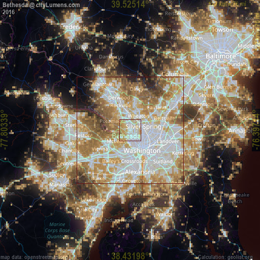
Analysis of Bethesda night lights 2016
Square area 10x10 km:
 25.81%
90-99
32.95%80-89
21.43%70-79
17.05%60-69
1.79%50-59
0.97%40-49
0%30-39
0%20-29
0%10-19
0%0-9
0%Square area 50x50 km:
24.99%90-99
18.79%80-89
10.32%70-79
13.33%60-69
11.58%50-59
7.82%40-49
3.76%30-39
2.41%20-29
2.76%10-19
2.1%0-9
2.14%Clear (daylight) street map image can be seen on geolist.org.
Map coordinates:
39° 31' 30.5" North, 77° 48' 12.2" West
38° 58' 50.4" North, 77° 6' 0.9" West
38° 25' 55.1" North, 76° 23' 49.7" West
Some cities around Bethesda sort by population:
• Silver Spring
6.5 km =4 mi,  80°
80°
• Wheaton
7.6 km =4.7 mi,  30°
30°
• North Bethesda
7.3 km =4.5 mi,  347°
347°
• Chevy Chase
3.5 km =2.2 mi,  45°
45°
• Chevy Chase
3.4 km =2.1 mi,  123°
123°
• North Kensington
6 km =3.7 mi,  23°
23°
• South Kensington
4.6 km =2.9 mi, 22°
• Forest Glen
5.4 km =3.4 mi, 46°
4348599 (p: 60,858)
Sources (retrieved 2019-11-25):
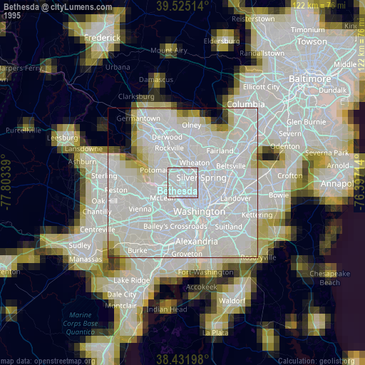
» NASA, Earths city lights 1995
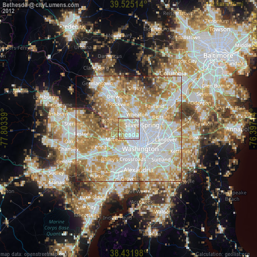
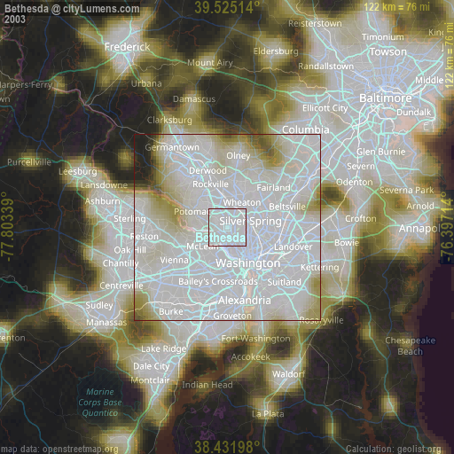
» NASA city lights 2003
» Earth at Night: Flat Maps 2012, 2016