Bensenville night lights from space
Night Light of Bensenville (Illinois) from space (United States) Src. Average luminocity for 10x10km area is 97.0603% and for 50x50km: 86.0232%.
Analysis of Bensenville night lights 2016
Square area 10x10 km:
 54.29%
90-99
32.06%80-89
11.9%70-79
1.75%60-69
0%50-59
0%40-49
0%30-39
0%20-29
0%10-19
0%0-9
0%Square area 50x50 km:
40.3%90-99
21.89%80-89
12.28%70-79
8.92%60-69
6%50-59
3.6%40-49
1.68%30-39
0.99%20-29
1.3%10-19
1.06%0-9
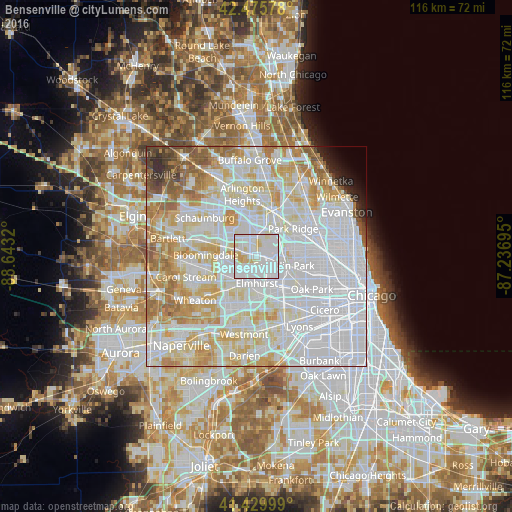
1.98%Clear (daylight) street map image can be seen on geolist.org.
Map coordinates:
42° 28' 32.8" North, 88° 38' 35.5" West
41° 57' 18.1" North, 87° 56' 24.3" West
41° 25' 48" North, 87° 14' 13" West
Some cities around Bensenville sort by population:
• Elmhurst
6.2 km =3.9 mi,  180°
180°
• Addison
4.8 km =3 mi,  237°
237°
• Elk Grove Village
6 km =3.7 mi,  335°
335°
• Franklin Park
6.5 km =4 mi,  109°
109°
• Wood Dale
3.3 km =2.1 mi,  286°
286°
• Northlake
5.6 km =3.5 mi,  138°
138°
• Schiller Park
5.7 km =3.5 mi,  89°
89°
• Itasca
6 km =3.7 mi, 291°
4884509 (p: 18,440)
Sources (retrieved 2019-11-25):
» Earth at Night: Flat Maps 2012, 2016