Harvard night lights from space
Night Light of Harvard (Illinois) from space (United States) Src. Average luminocity for 10x10km area is 12.8683% and for 50x50km: 12.736%.
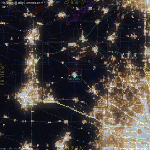
Analysis of Harvard night lights 2016
Square area 10x10 km:
 1.11%
1.11%90-99
2.22%80-89
2.06%70-79
1.9%60-69
1.27%50-59
1.59%40-49
0.63%30-39
1.59%20-29
3.49%10-19
1.43%0-9
82.7%Square area 50x50 km:
0.7%90-99
0.81%80-89
1.93%70-79
1.77%60-69
2.05%50-59
2.43%40-49
2.17%30-39
2.39%20-29
4.08%10-19
10.46%0-9
71.22%Clear (daylight) street map image can be seen on geolist.org.
Map coordinates:
42° 56' 20.9" North, 89° 19' 0.6" West
42° 25' 20.1" North, 88° 36' 49.4" West
41° 54' 3.8" North, 87° 54' 38.1" West
Some cities around Harvard sort by population:
• McHenry
30.2 km =18.8 mi,  109°
109°
• Woodstock
18.1 km =11.2 mi,  131°
131°
• Belvidere
25.9 km =16.1 mi,  227°
227°
• Elkhorn
28.4 km =17.6 mi,  11°
11°
• Delavan
23.6 km =14.7 mi,  354°
354°
• Lake Geneva
23.9 km =14.9 mi,  38°
38°
• Marengo
19.3 km =12 mi,  178°
178°
• Poplar Grove
18.1 km =11.2 mi,  250°
250°
4895282 (p: 9,194)
Sources (retrieved 2019-11-25):
» Earth at Night: Flat Maps 2012, 2016