Bel Air North night lights from space
Night Light of Bel Air North (Maryland) from space (United States) Src. Average luminocity for 10x10km area is 53.5958% and for 50x50km: 27.4683%.
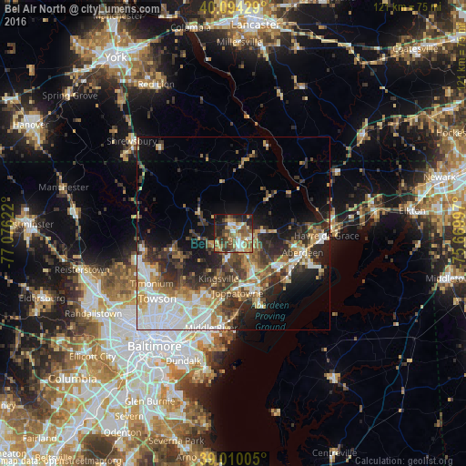
Analysis of Bel Air North night lights 2016
Square area 10x10 km:
 5.68%
5.68%90-99
8.28%80-89
8.28%70-79
7.95%60-69
10.23%50-59
14.12%40-49
9.74%30-39
11.04%20-29
12.34%10-19
11.69%0-9
0.65%Square area 50x50 km:
5.77%90-99
4.39%80-89
3.2%70-79
3.68%60-69
3.41%50-59
3.78%40-49
4.38%30-39
5.33%20-29
7.25%10-19
9.49%0-9
49.32%Clear (daylight) street map image can be seen on geolist.org.
Map coordinates:
40° 5' 39.4" North, 77° 4' 34.4" West
39° 33' 15.4" North, 76° 22' 23.1" West
39° 0' 36.2" North, 75° 40' 11.9" West
Some cities around Bel Air North sort by population:
• South Bel Air
3.9 km =2.4 mi,  127°
127°
• North Bel Air
2.2 km =1.4 mi,  135°
135°
• Perry Hall
17.6 km =10.9 mi,  206°
206°
• Edgewood
16.5 km =10.3 mi,  155°
155°
• Aberdeen
18.6 km =11.6 mi,  105°
105°
• Joppatowne
10.8 km =6.7 mi,  171°
171°
• Fallston
5.5 km =3.4 mi,  216°
216°
• Riverside
14.4 km =8.9 mi, 128°
7257991 (p: 30,568)
Sources (retrieved 2019-11-25):
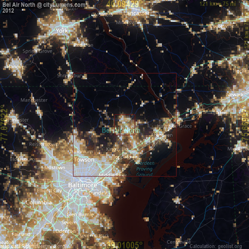
» Earth at Night: Flat Maps 2012, 2016