Perry Hall night lights from space
Night Light of Perry Hall (Maryland) from space (United States) Src. Average luminocity for 10x10km area is 66.7653% and for 50x50km: 44.6349%.
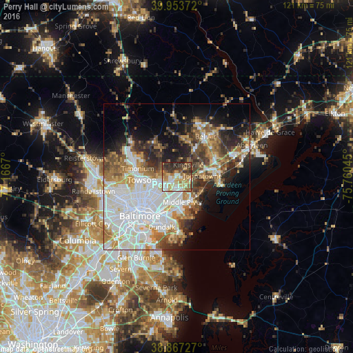
Analysis of Perry Hall night lights 2016
Square area 10x10 km:
 10.2%
10.2%90-99
14.29%80-89
12.76%70-79
14.29%60-69
9.86%50-59
9.01%40-49
8.84%30-39
11.56%20-29
9.18%10-19
0%0-9
0%Square area 50x50 km:
14.53%90-99
9.36%80-89
4.32%70-79
5.01%60-69
5.06%50-59
4.94%40-49
5.24%30-39
5.31%20-29
6.71%10-19
8.93%0-9
30.58%Clear (daylight) street map image can be seen on geolist.org.
Map coordinates:
39° 57' 13.4" North, 77° 10' 0.1" West
39° 24' 45.4" North, 76° 27' 48.9" West
38° 52' 2.2" North, 75° 45' 37.6" West
Some cities around Perry Hall sort by population:
• Parkville
7.6 km =4.7 mi,  239°
239°
• Carney
5.5 km =3.4 mi,  248°
248°
• Middle River
9 km =5.6 mi,  166°
166°
• Rossville
8.4 km =5.2 mi,  189°
189°
• Joppatowne
10.6 km =6.6 mi,  61°
61°
• Overlea
7.3 km =4.5 mi,  221°
221°
• White Marsh
4.2 km =2.6 mi,  139°
139°
• Hampton
10.5 km =6.5 mi,  276°
276°
4365227 (p: 28,474)
Sources (retrieved 2019-11-25):
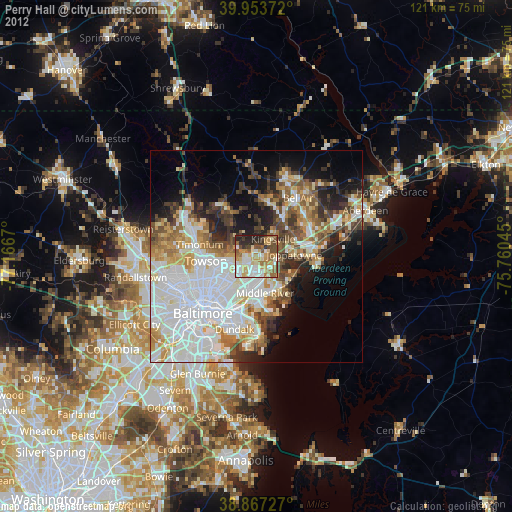
» Earth at Night: Flat Maps 2012, 2016