Baytown night lights from space
Night Light of Baytown (Texas) from space (United States) Src. Average luminocity for 10x10km area is 84.506% and for 50x50km: 52.1219%.
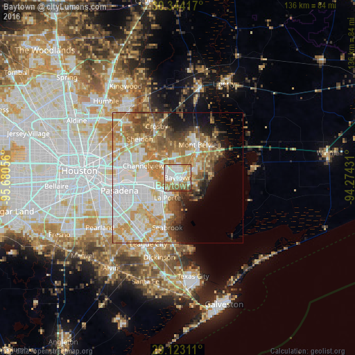
Analysis of Baytown night lights 2016
Square area 10x10 km:
 25.99%
90-99
25.4%80-89
12.3%70-79
12.3%60-69
14.09%50-59
6.94%40-49
2.58%30-39
0.4%20-29
0%10-19
0%0-9
0%Square area 50x50 km:
14.34%90-99
11.13%80-89
7.43%70-79
8.8%60-69
9.22%50-59
5.69%40-49
4.3%30-39
3.41%20-29
2.98%10-19
5.74%0-9
26.97%Clear (daylight) street map image can be seen on geolist.org.
Map coordinates:
30° 20' 39" North, 95° 40' 50" West
29° 44' 7.8" North, 94° 58' 38.7" West
29° 7' 23.2" North, 94° 16' 27.5" West
Some cities around Baytown sort by population:
• Pasadena
22.9 km =14.2 mi,  257°
257°
• Channelview
14 km =8.7 mi,  288°
288°
• La Porte
8.7 km =5.4 mi,  207°
207°
• Deer Park
14.5 km =9 mi, 256°
• Cloverleaf
19.4 km =12.1 mi,  284°
284°
• Seabrook
19.6 km =12.2 mi,  193°
193°
• Highlands
12 km =7.5 mi,  320°
320°
• Mont Belvieu
15 km =9.3 mi,  33°
33°
4672731 (p: 76,335)
Sources (retrieved 2019-11-25):
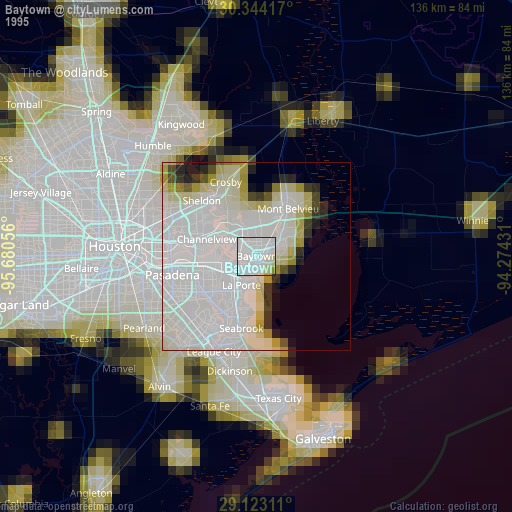
» NASA, Earths city lights 1995
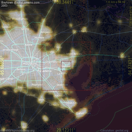
» NASA city lights 2003
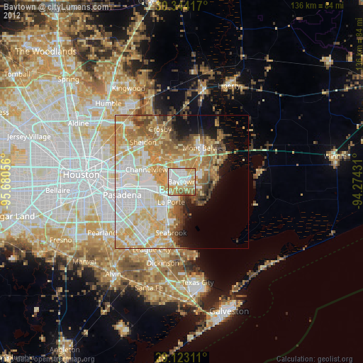
» Earth at Night: Flat Maps 2012, 2016