Highlands night lights from space
Night Light of Highlands (Texas) from space (United States) Src. Average luminocity for 10x10km area is 70.3611% and for 50x50km: 63.8517%.
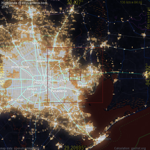
Analysis of Highlands night lights 2016
Square area 10x10 km:
 5.95%
5.95%90-99
6.94%80-89
12.7%70-79
11.71%60-69
44.64%50-59
15.67%40-49
2.38%30-39
0%20-29
0%10-19
0%0-9
0%Square area 50x50 km:
19.36%90-99
14.29%80-89
8.85%70-79
9.32%60-69
10.66%50-59
6.4%40-49
4.77%30-39
3.95%20-29
3.15%10-19
7.34%0-9
11.92%Clear (daylight) street map image can be seen on geolist.org.
Map coordinates:
30° 25' 37.2" North, 95° 45' 33" West
29° 49' 7.8" North, 95° 3' 21.7" West
29° 12' 25" North, 94° 21' 10.5" West
Some cities around Highlands sort by population:
• Baytown
12 km =7.5 mi,  140°
140°
• Channelview
7.4 km =4.6 mi,  229°
229°
• La Porte
17.4 km =10.8 mi,  168°
168°
• Deer Park
14.2 km =8.8 mi,  207°
207°
• Cloverleaf
12.1 km =7.5 mi,  248°
248°
• Galena Park
19.3 km =12 mi,  240°
240°
• Jacinto City
18.1 km =11.2 mi, 251°
• Mont Belvieu
16.3 km =10.1 mi,  78°
78°
4697652 (p: 7,522)
Sources (retrieved 2019-11-25):
» Earth at Night: Flat Maps 2012, 2016