Pasadena night lights from space
Night Light of Pasadena (Texas) from space (United States) Src. Average luminocity for 10x10km area is 99.4563% and for 50x50km: 84.0015%.
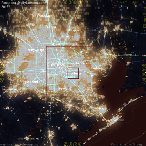

Analysis of Pasadena night lights 2016
Square area 10x10 km:
 68.85%
90-99
30.16%80-89
0.99%70-79
0%60-69
0%50-59
0%40-49
0%30-39
0%20-29
0%10-19
0%0-9
0%Square area 50x50 km:
34.8%90-99
20.5%80-89
10.44%70-79
11.1%60-69
10%50-59
5.52%40-49
3.49%30-39
2.07%20-29
1.38%10-19
0.69%0-9
0.01%Clear (daylight) street map image can be seen on geolist.org.
Map coordinates:
30° 18' 0" North, 95° 54' 44" West
29° 41' 27.8" North, 95° 12' 32.8" West
29° 4' 42.2" North, 94° 30' 21.5" West
Some cities around Pasadena sort by population:
• Houston
16.9 km =10.5 mi,  298°
298°
• Pearland
16 km =9.9 mi,  207°
207°
• Channelview
13.1 km =8.1 mi,  43°
43°
• Deer Park
8.4 km =5.2 mi,  79°
79°
• Cloverleaf
10.3 km =6.4 mi,  20°
20°
• South Houston
4 km =2.5 mi,  219°
219°
• Galena Park
5.1 km =3.2 mi,  336°
336°
• Jacinto City
8.8 km =5.5 mi, 344°
4717782 (p: 153,784)
Sources (retrieved 2019-11-25):
» NASA, Earths city lights 1995
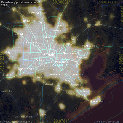
» NASA city lights 2003
» Earth at Night: Flat Maps 2012, 2016