Sault Ste. Marie night lights from space
Night Light of Sault Ste. Marie (Ontario) from space (Canada) Src. Average luminocity for 10x10km area is 62.0639% and for 50x50km: 3.9294%.
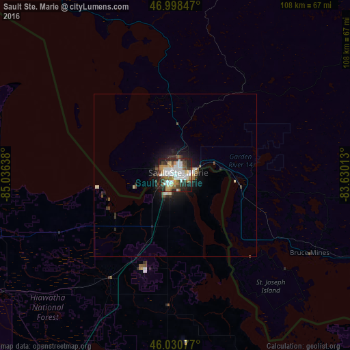
Analysis of Sault Ste. Marie night lights 2016
Square area 10x10 km:
 18.04%
90-99
16.34%80-89
4.4%70-79
8.1%60-69
5.54%50-59
4.69%40-49
8.24%30-39
8.24%20-29
18.18%10-19
8.1%0-9
0.14%Square area 50x50 km:
0.79%90-99
0.84%80-89
0.27%70-79
0.36%60-69
0.3%50-59
0.41%40-49
0.52%30-39
0.71%20-29
1.25%10-19
2.57%0-9
91.98%Clear (daylight) street map image can be seen on geolist.org.
Map coordinates:
46° 59' 54.5" North, 85° 2' 11" West
46° 31' 0.4" North, 84° 19' 59.7" West
46° 1' 50.8" North, 83° 37' 48.5" West
Some cities around Sault Ste. Marie sort by population:
• Marquette, US
234.2 km =145.5 mi,  270°
270°
• Rayside-Balfour
239.2 km =148.6 mi,  87°
87°
• Traverse City, US
219.2 km =136.2 mi,  207°
207°
• Elliot Lake
131.1 km =81.5 mi,  96°
96°
• Escanaba, US
227.3 km =141.2 mi,  247°
247°
• Alpena, US
176.2 km =109.5 mi,  156°
156°
• Bay Harbor, US
140.6 km =87.4 mi,  204°
204°
• Petoskey, US
135.9 km =84.4 mi, 200°
6141439 (p: 66,313)
Sources (retrieved 2019-11-25):
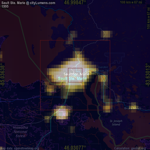
» NASA, Earths city lights 1995
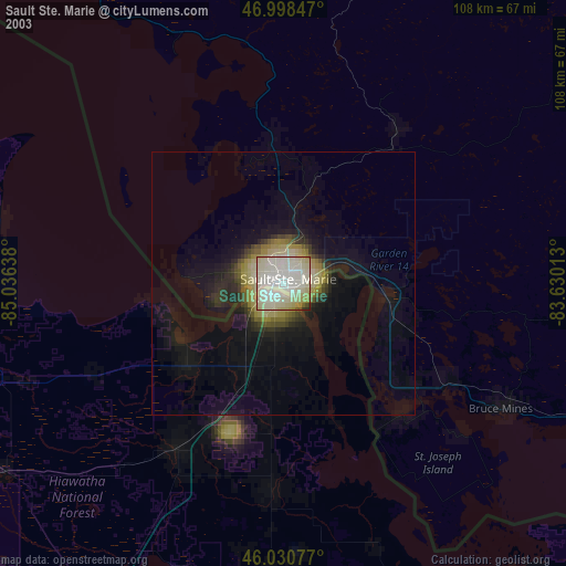
» NASA city lights 2003
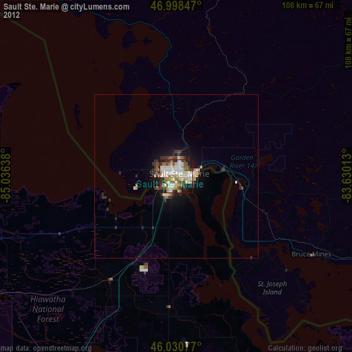
» Earth at Night: Flat Maps 2012, 2016