Bangor Trident Base night lights from space
Night Light of Bangor Trident Base (Washington) from space (United States) Src. Average luminocity for 10x10km area is 28.942% and for 50x50km: 8.1929%.
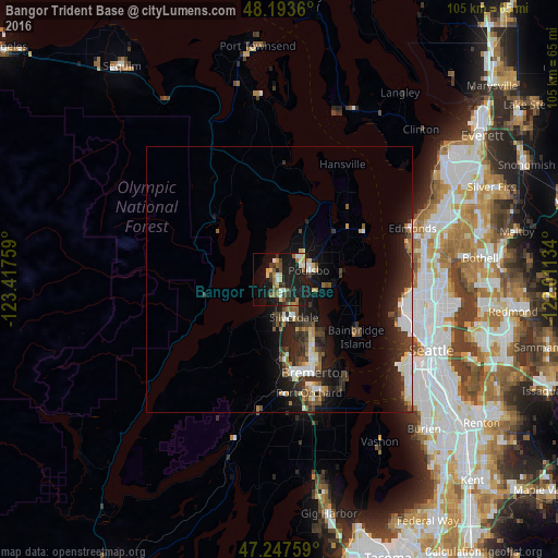
Analysis of Bangor Trident Base night lights 2016
Square area 10x10 km:
 2.83%
2.83%90-99
3.13%80-89
5.21%70-79
2.08%60-69
3.57%50-59
6.25%40-49
3.27%30-39
4.91%20-29
6.25%10-19
37.35%0-9
25.15%Square area 50x50 km:
1.16%90-99
1.34%80-89
0.79%70-79
0.51%60-69
0.85%50-59
1.07%40-49
1.35%30-39
1.7%20-29
3.18%10-19
7.28%0-9
80.75%Clear (daylight) street map image can be seen on geolist.org.
Map coordinates:
48° 11' 37" North, 123° 25' 3.3" West
47° 43' 21.9" North, 122° 42' 52.1" West
47° 14' 51.3" North, 122° 0' 40.8" West
Some cities around Bangor Trident Base sort by population:
• Bremerton
18.3 km =11.4 mi,  160°
160°
• Bainbridge Island
18 km =11.2 mi,  126°
126°
• Silverdale
8.8 km =5.5 mi,  170°
170°
• Port Orchard
21.1 km =13.1 mi, 163°
• Poulsbo
5.3 km =3.3 mi,  73°
73°
• Parkwood
22.5 km =14 mi, 159°
• Manchester
22.5 km =14 mi,  145°
145°
• Tracyton
13.4 km =8.3 mi, 160°
7260845 (p: 6,054)
Sources (retrieved 2019-11-25):
» Earth at Night: Flat Maps 2012, 2016