Aurora night lights from space
Night Light of Aurora (Colorado) from space (United States) Src. Average luminocity for 10x10km area is 96.7289% and for 50x50km: 58.6954%.
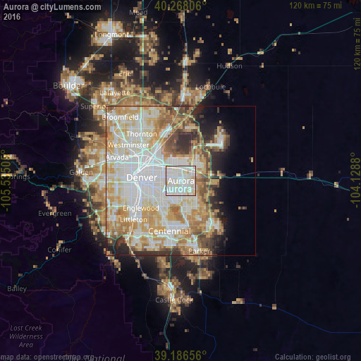
Analysis of Aurora night lights 2016
Square area 10x10 km:
 42.37%
90-99
44.97%80-89
9.25%70-79
3.41%60-69
0%50-59
0%40-49
0%30-39
0%20-29
0%10-19
0%0-9
0%Square area 50x50 km:
17.66%90-99
14.69%80-89
8.43%70-79
10.42%60-69
6.74%50-59
4.5%40-49
3.96%30-39
3.72%20-29
4.39%10-19
4.76%0-9
20.73%Clear (daylight) street map image can be seen on geolist.org.
Map coordinates:
40° 16' 5" North, 105° 32' 6.2" West
39° 43' 45.9" North, 104° 49' 54.9" West
39° 11' 11.6" North, 104° 7' 43.7" West
Some cities around Aurora sort by population:
• Denver
13.1 km =8.1 mi,  274°
274°
• Commerce City
12.4 km =7.7 mi,  315°
315°
• Englewood
16.1 km =10 mi,  235°
235°
• Greenwood Village
16.1 km =10 mi,  219°
219°
• Cherry Creek
11.4 km =7.1 mi,  202°
202°
• Derby
14.3 km =8.9 mi,  328°
328°
• Cherry Hills Village
14.6 km =9.1 mi,  228°
228°
• Glendale
9.1 km =5.7 mi,  252°
252°
5412347 (p: 359,407)
Sources (retrieved 2019-11-25):
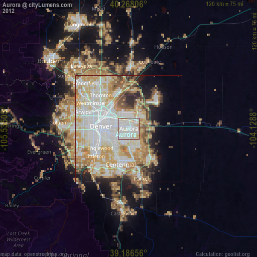
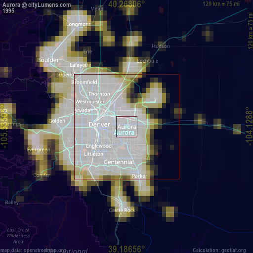
» NASA, Earths city lights 1995
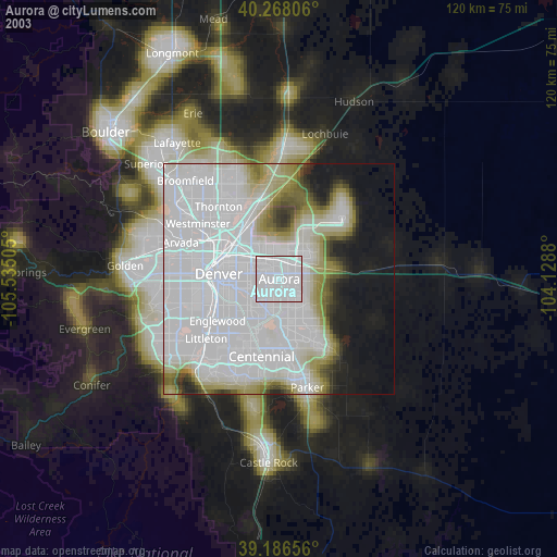
» NASA city lights 2003
» Earth at Night: Flat Maps 2012, 2016