Jacinto City night lights from space
Night Light of Jacinto City (Texas) from space (United States) Src. Average luminocity for 10x10km area is 96.7262% and for 50x50km: 86.8983%.
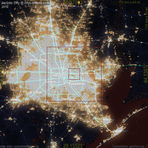
Analysis of Jacinto City night lights 2016
Square area 10x10 km:
 50.2%
50.2%90-99
33.73%80-89
14.48%70-79
1.59%60-69
0%50-59
0%40-49
0%30-39
0%20-29
0%10-19
0%0-9
0%Square area 50x50 km:
39.95%90-99
23.26%80-89
9.58%70-79
9.78%60-69
7.42%50-59
3.81%40-49
2.62%30-39
1.5%20-29
0.81%10-19
1.1%0-9
0.17%Clear (daylight) street map image can be seen on geolist.org.
Map coordinates:
30° 22' 33.3" North, 95° 56' 13" West
29° 46' 2.8" North, 95° 14' 1.8" West
29° 9' 18.9" North, 94° 31' 50.5" West
Some cities around Jacinto City sort by population:
• Houston
12.5 km =7.8 mi,  267°
267°
• Pasadena
8.8 km =5.5 mi,  164°
164°
• Channelview
11.5 km =7.1 mi,  85°
85°
• Deer Park
12.7 km =7.9 mi,  123°
123°
• Cloverleaf
6.1 km =3.8 mi,  78°
78°
• South Houston
11.6 km =7.2 mi,  180°
180°
• Galena Park
3.8 km =2.4 mi,  174°
174°
• Highlands
18.1 km =11.2 mi,  71°
71°
4700401 (p: 10,782)
Sources (retrieved 2019-11-25):
» Earth at Night: Flat Maps 2012, 2016