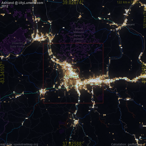
Ashland night lights from space
Night Light of Ashland (Kentucky) from space (United States) Src. Average luminocity for 10x10km area is 66.1445% and for 50x50km: 17.0869%.

Analysis of Ashland night lights 2016
Square area 10x10 km:
 12.01%
90-99
16.88%80-89
10.23%70-79
9.58%60-69
12.18%50-59
9.09%40-49
6.98%30-39
9.42%20-29
8.77%10-19
4.38%0-9
0.49%Square area 50x50 km:
1.7%90-99
2.84%80-89
1.74%70-79
1.89%60-69
2.5%50-59
2.7%40-49
3.56%30-39
3.97%20-29
5.71%10-19
9.91%0-9
63.49%Clear (daylight) street map image can be seen on geolist.org.
Map coordinates:
39° 1' 36.3" North, 83° 20' 27.9" West
38° 28' 42.3" North, 82° 38' 16.6" West
37° 55' 33.2" North, 81° 56' 5.4" West
Some cities around Ashland sort by population:
• Meads
9.6 km =6 mi,  220°
220°
• Ironville
5.3 km =3.3 mi,  242°
242°
• Huntington
18 km =11.2 mi,  111°
111°
• Portsmouth
42.1 km =26.2 mi,  312°
312°
• Ironton
7.6 km =4.7 mi,  328°
328°
• Flatwoods
8.5 km =5.3 mi, 305°
• Pea Ridge
28.6 km =17.8 mi,  104°
104°
• Wheelersburg
33.8 km =21 mi, 325°
4282757 (p: 21,108)
Sources (retrieved 2019-11-25):
» Earth at Night: Flat Maps 2012, 2016