Arkansas City night lights from space
Night Light of Arkansas City (Kansas) from space (United States) Src. Average luminocity for 10x10km area is 20.267% and for 50x50km: 2.9396%.
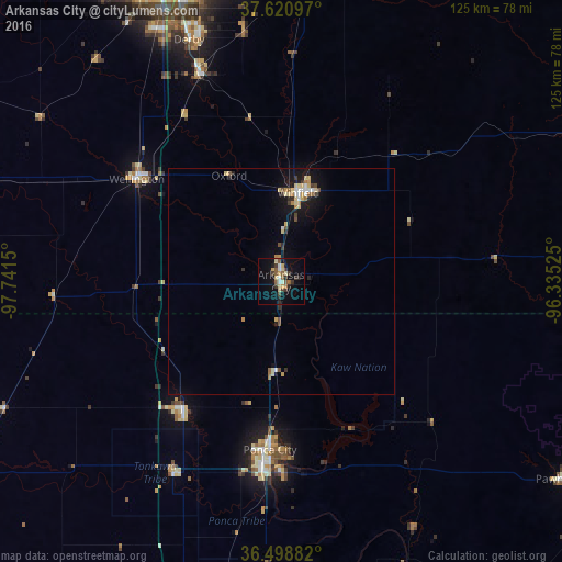
Analysis of Arkansas City night lights 2016
Square area 10x10 km:
 1.02%
1.02%90-99
2.38%80-89
5.1%70-79
1.7%60-69
1.02%50-59
4.76%40-49
1.53%30-39
5.61%20-29
3.06%10-19
13.78%0-9
60.03%Square area 50x50 km:
0.25%90-99
0.27%80-89
0.71%70-79
0.3%60-69
0.25%50-59
0.44%40-49
0.27%30-39
0.42%20-29
0.44%10-19
2.36%0-9
94.29%Clear (daylight) street map image can be seen on geolist.org.
Map coordinates:
37° 37' 15.5" North, 97° 44' 29.4" West
37° 3' 43.1" North, 97° 2' 18.1" West
36° 29' 55.8" North, 96° 20' 6.9" West
Some cities around Arkansas City sort by population:
• Ponca City
39.7 km =24.7 mi,  186°
186°
• Derby
57.5 km =35.7 mi,  339°
339°
• Winfield
20.1 km =12.5 mi,  10°
10°
• Haysville
62.4 km =38.8 mi,  333°
333°
• Augusta
69.7 km =43.3 mi,  4°
4°
• Wellington
37.2 km =23.1 mi,  307°
307°
• Blackwell
35.9 km =22.3 mi,  217°
217°
• Mulvane
49.3 km =30.6 mi, 338°
4267661 (p: 12,136)
Sources (retrieved 2019-11-25):
» Earth at Night: Flat Maps 2012, 2016