Amityville night lights from space
Night Light of Amityville (New York) from space (United States) Src. Average luminocity for 10x10km area is 76.4481% and for 50x50km: 47.4139%.
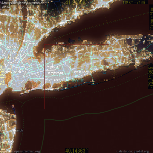
Analysis of Amityville night lights 2016
Square area 10x10 km:
 31.33%
90-99
30.52%80-89
4.71%70-79
1.79%60-69
2.27%50-59
2.76%40-49
1.95%30-39
7.14%20-29
14.12%10-19
3.41%0-9
0%Square area 50x50 km:
15.88%90-99
11.48%80-89
5.76%70-79
7.03%60-69
5.95%50-59
4.7%40-49
2.71%30-39
2.2%20-29
4.11%10-19
4.49%0-9
35.69%Clear (daylight) street map image can be seen on geolist.org.
Map coordinates:
41° 12' 36.3" North, 74° 7' 12.7" West
40° 40' 44.4" North, 73° 25' 1.5" West
40° 8' 37.1" North, 72° 42' 50.2" West
Some cities around Amityville sort by population:
• Lindenhurst
3.8 km =2.4 mi,  76°
76°
• Copiague
1.5 km =0.9 mi, 79°
• Massapequa
4.8 km =3 mi,  272°
272°
• East Massapequa
1.8 km =1.1 mi,  249°
249°
• North Massapequa
4.5 km =2.8 mi,  302°
302°
• North Amityville
2.2 km =1.4 mi,  341°
341°
• Massapequa Park
3.2 km =2 mi, 272°
• North Lindenhurst
4.9 km =3 mi,  37°
37°
5107140 (p: 9,486)
Sources (retrieved 2019-11-25):
» Earth at Night: Flat Maps 2012, 2016