Muleshoe night lights from space
Night Light of Muleshoe (Texas) from space (United States) Src. Average luminocity for 10x10km area is 12.185% and for 50x50km: 1.2231%.
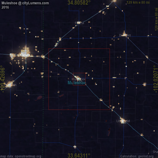
Analysis of Muleshoe night lights 2016
Square area 10x10 km:
 0.73%
0.73%90-99
1.83%80-89
1.1%70-79
1.47%60-69
3.11%50-59
1.28%40-49
3.11%30-39
2.75%20-29
0.55%10-19
0.55%0-9
83.52%Square area 50x50 km:
0.05%90-99
0.08%80-89
0.14%70-79
0.13%60-69
0.22%50-59
0.26%40-49
0.37%30-39
0.47%20-29
0.14%10-19
0.18%0-9
97.96%Clear (daylight) street map image can be seen on geolist.org.
Map coordinates:
34° 48' 21" North, 103° 25' 37.1" West
34° 13' 35.3" North, 102° 43' 25.8" West
33° 38' 35.2" North, 102° 1' 14.6" West
Some cities around Muleshoe sort by population:
• Lubbock
107.8 km =67 mi,  131°
131°
• Clovis
48.5 km =30.1 mi,  294°
294°
• Plainview
93.6 km =58.2 mi,  92°
92°
• Hereford
71.9 km =44.7 mi,  24°
24°
• Canyon
111.6 km =69.3 mi,  41°
41°
• Levelland
77.9 km =48.4 mi,  155°
155°
• Portales
56.3 km =35 mi,  265°
265°
• Littlefield
50.3 km =31.3 mi, 133°
5526805 (p: 5,185)
Sources (retrieved 2019-11-25):
» Earth at Night: Flat Maps 2012, 2016