Alta Sierra night lights from space
Night Light of Alta Sierra (California) from space (United States) Src. Average luminocity for 10x10km area is 0% and for 50x50km: 0.4799%.
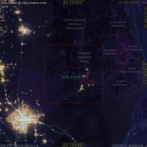
Analysis of Alta Sierra night lights 2016
Square area 10x10 km:
 0%
0%90-99
0%80-89
0%70-79
0%60-69
0%50-59
0%40-49
0%30-39
0%20-29
0%10-19
0%0-9
100%Square area 50x50 km:
0%90-99
0%80-89
0%70-79
0.11%60-69
0.21%50-59
0.06%40-49
0.16%30-39
0.1%20-29
0.14%10-19
0.08%0-9
99.14%Clear (daylight) street map image can be seen on geolist.org.
Map coordinates:
36° 17' 59.9" North, 119° 15' 25.3" West
35° 43' 52.5" North, 118° 33' 14" West
35° 9' 30.4" North, 117° 51' 2.8" West
Some cities around Alta Sierra sort by population:
• Bakersfield
57.9 km =36 mi,  226°
226°
• Porterville
55.8 km =34.7 mi,  311°
311°
• Delano
62.7 km =39 mi,  273°
273°
• Oildale
54.5 km =33.9 mi, 230°
• Arvin
63.2 km =39.3 mi,  203°
203°
• Lamont
61.8 km =38.4 mi,  211°
211°
• McFarland
61.3 km =38.1 mi,  264°
264°
• East Porterville
52.5 km =32.6 mi, 313°
5323499 (p: 7,047)
Sources (retrieved 2019-11-25):
» Earth at Night: Flat Maps 2012, 2016