Delano night lights from space
Night Light of Delano (California) from space (United States) Src. Average luminocity for 10x10km area is 30.208% and for 50x50km: 4.523%.
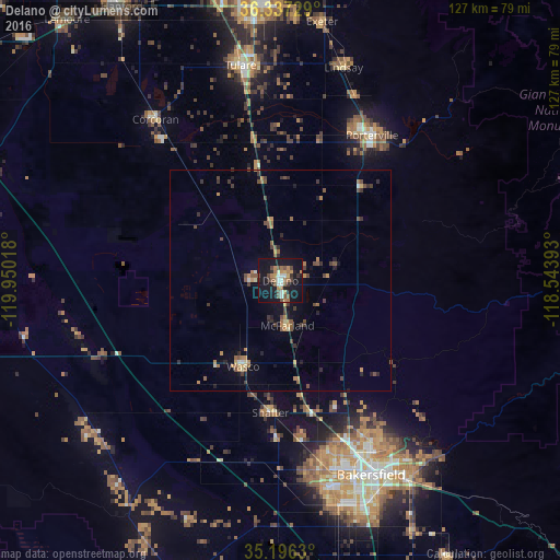
Analysis of Delano night lights 2016
Square area 10x10 km:
 1.75%
1.75%90-99
5.07%80-89
0.7%70-79
5.07%60-69
7.87%50-59
4.55%40-49
5.59%30-39
2.8%20-29
2.62%10-19
52.45%0-9
11.54%Square area 50x50 km:
0.16%90-99
0.28%80-89
0.27%70-79
0.7%60-69
1%50-59
0.81%40-49
1.06%30-39
0.9%20-29
0.7%10-19
3.25%0-9
90.89%Clear (daylight) street map image can be seen on geolist.org.
Map coordinates:
36° 20' 14.2" North, 119° 57' 0.6" West
35° 46' 7.8" North, 119° 14' 49.4" West
35° 11' 46.7" North, 118° 32' 38.1" West
Some cities around Delano sort by population:
• Porterville
38.9 km =24.2 mi,  32°
32°
• Oildale
43.9 km =27.3 mi,  152°
152°
• Wasco
21.2 km =13.2 mi,  203°
203°
• Shafter
29.9 km =18.6 mi,  184°
184°
• Rosedale
43.8 km =27.2 mi,  167°
167°
• McFarland
10.2 km =6.3 mi, 170°
• Earlimart
13 km =8.1 mi,  349°
349°
• East Porterville
40.3 km =25 mi,  37°
37°
5342485 (p: 52,733)
Sources (retrieved 2019-11-25):
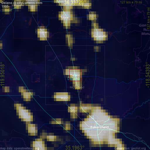
» NASA, Earths city lights 1995
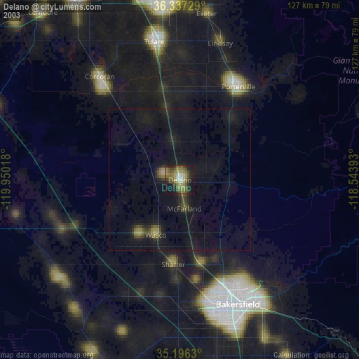
» NASA city lights 2003
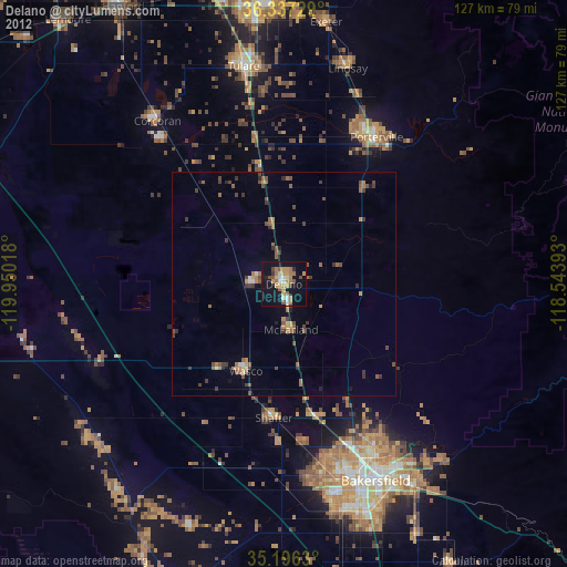
» Earth at Night: Flat Maps 2012, 2016