McFarland night lights from space
Night Light of McFarland (California) from space (United States) Src. Average luminocity for 10x10km area is 15.0332% and for 50x50km: 6.8206%.
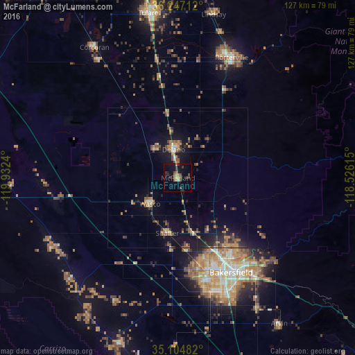
Analysis of McFarland night lights 2016
Square area 10x10 km:
 0%
0%90-99
0%80-89
2.1%70-79
1.57%60-69
2.97%50-59
2.97%40-49
2.45%30-39
6.12%20-29
2.45%10-19
14.34%0-9
65.03%Square area 50x50 km:
0.21%90-99
0.34%80-89
0.34%70-79
1.17%60-69
1.6%50-59
1.22%40-49
1.48%30-39
1.34%20-29
1.54%10-19
6.33%0-9
84.44%Clear (daylight) street map image can be seen on geolist.org.
Map coordinates:
36° 14' 49.6" North, 119° 55' 56.6" West
35° 40' 40.8" North, 119° 13' 45.4" West
35° 6' 17.4" North, 118° 31' 34.1" West
Some cities around McFarland sort by population:
• Bakersfield
38.9 km =24.2 mi,  150°
150°
• Delano
10.2 km =6.3 mi,  350°
350°
• Oildale
34.4 km =21.4 mi, 146°
• Wasco
13.7 km =8.5 mi,  227°
227°
• Shafter
20.1 km =12.5 mi,  191°
191°
• Rosedale
33.6 km =20.9 mi,  166°
166°
• Earlimart
23.2 km =14.4 mi, 350°
• Greenacres
34.5 km =21.4 mi,  161°
161°
5371530 (p: 13,985)
Sources (retrieved 2019-11-25):
» Earth at Night: Flat Maps 2012, 2016