Battle Creek night lights from space
Night Light of Battle Creek (Michigan) from space (United States) Src. Average luminocity for 10x10km area is 64.3439% and for 50x50km: 7.4432%.
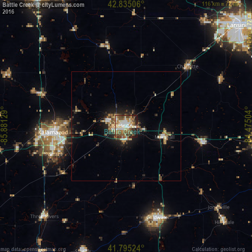
Analysis of Battle Creek night lights 2016
Square area 10x10 km:
 11.06%
90-99
13.18%80-89
12.58%70-79
6.36%60-69
11.21%50-59
15%40-49
11.06%30-39
6.67%20-29
7.12%10-19
5.76%0-9
0%Square area 50x50 km:
0.75%90-99
1%80-89
1.11%70-79
0.7%60-69
1.28%50-59
1.17%40-49
1.17%30-39
1.2%20-29
2.02%10-19
4.67%0-9
84.92%Clear (daylight) street map image can be seen on geolist.org.
Map coordinates:
42° 50' 6.2" North, 85° 52' 52.6" West
42° 19' 2.3" North, 85° 10' 41.4" West
41° 47' 42.9" North, 84° 28' 30.1" West
Some cities around Battle Creek sort by population:
• Kalamazoo
33.8 km =21 mi,  265°
265°
• Portage
35.5 km =22.1 mi,  248°
248°
• Westwood
37.5 km =23.3 mi, 267°
• Albion
35.9 km =22.3 mi,  103°
103°
• Marshall
18.4 km =11.4 mi,  105°
105°
• Eastwood
30.6 km =19 mi, 267°
• Comstock Northwest
27.9 km =17.3 mi, 271°
• Springfield
5.1 km =3.2 mi,  281°
281°
4985153 (p: 51,589)
Sources (retrieved 2019-11-25):
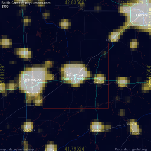
» NASA, Earths city lights 1995
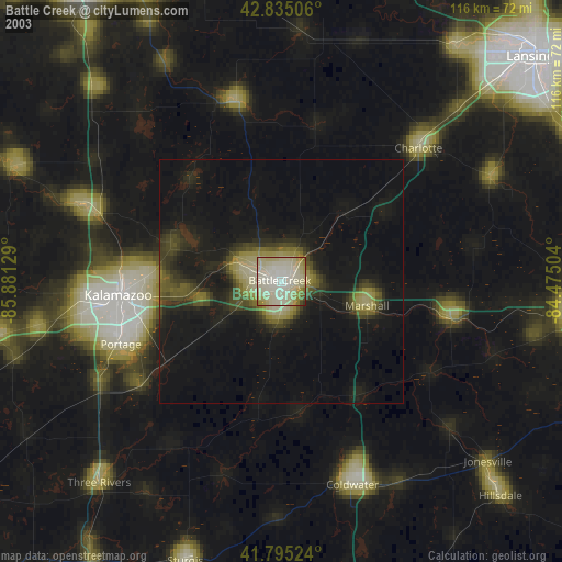
» NASA city lights 2003
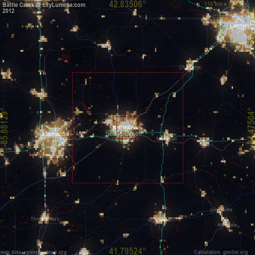
» Earth at Night: Flat Maps 2012, 2016