Springfield night lights from space
Night Light of Springfield (Missouri) from space (United States) Src. Average luminocity for 10x10km area is 96.6463% and for 50x50km: 21.7205%.
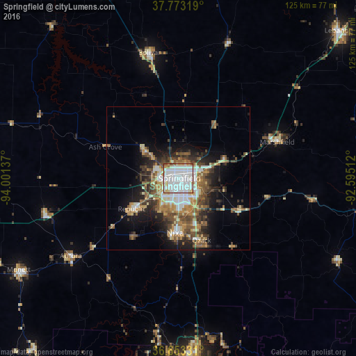
Analysis of Springfield night lights 2016
Square area 10x10 km:
 59.52%
90-99
29.76%80-89
5.1%70-79
2.72%60-69
0.85%50-59
2.04%40-49
0%30-39
0%20-29
0%10-19
0%0-9
0%Square area 50x50 km:
4.53%90-99
3.53%80-89
2.56%70-79
2.66%60-69
2.64%50-59
3.91%40-49
3.15%30-39
3.53%20-29
4.45%10-19
8.53%0-9
60.5%Clear (daylight) street map image can be seen on geolist.org.
Map coordinates:
37° 46' 23.5" North, 94° 0' 4.9" West
37° 12' 55.2" North, 93° 17' 53.7" West
36° 39' 11.9" North, 92° 35' 42.4" West
Some cities around Springfield sort by population:
• Nixa
19.1 km =11.9 mi,  178°
178°
• Ozark
23.1 km =14.4 mi,  159°
159°
• Republic
19.3 km =12 mi,  236°
236°
• Bolivar
45.5 km =28.3 mi,  347°
347°
• Aurora
46.1 km =28.6 mi,  233°
233°
• Marshfield
37.2 km =23.1 mi,  68°
68°
• Battlefield
12.8 km =8 mi,  209°
209°
• Willard
15.2 km =9.4 mi,  310°
310°
4409896 (p: 166,810)
Sources (retrieved 2019-11-25):
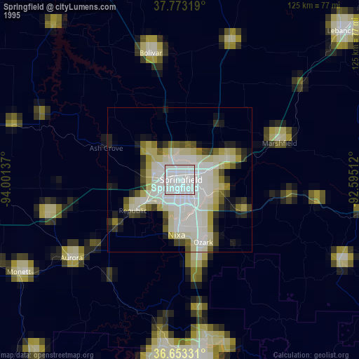
» NASA, Earths city lights 1995
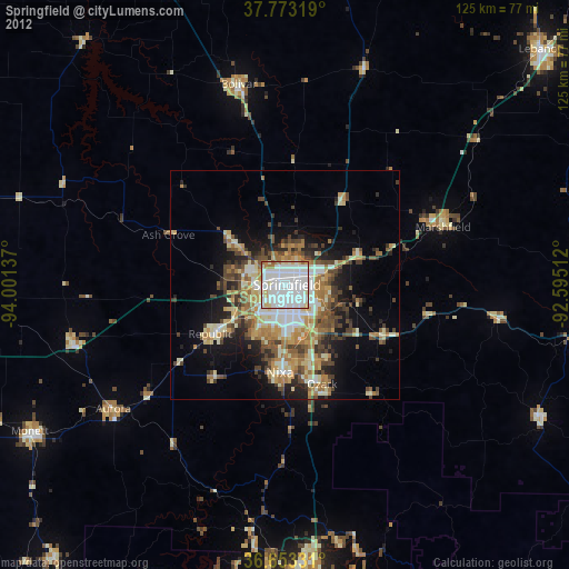
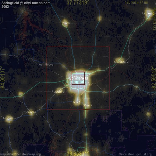
» NASA city lights 2003
» Earth at Night: Flat Maps 2012, 2016