Tomakivka night lights from space
Night Light of Tomakivka (Dnipropetrovsk) from space (Ukraine) Src. Average luminocity for 10x10km area is 2.0685% and for 50x50km: 2.3991%.
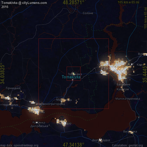
Analysis of Tomakivka night lights 2016
Square area 10x10 km:
 0%
0%90-99
0%80-89
0%70-79
0.6%60-69
0.15%50-59
1.04%40-49
0.6%30-39
1.19%20-29
0%10-19
0.6%0-9
95.83%Square area 50x50 km:
0.3%90-99
0.42%80-89
0.16%70-79
0.21%60-69
0.28%50-59
0.48%40-49
0.37%30-39
0.41%20-29
0.68%10-19
1.78%0-9
94.92%Clear (daylight) street map image can be seen on geolist.org.
Map coordinates:
48° 17' 8.6" North, 34° 2' 17.7" East
47° 48' 56.5" North, 34° 44' 28.9" East
47° 20' 29" North, 35° 26' 40.2" East
Some cities around Tomakivka sort by population:
• Zaporizhia
33.5 km =20.8 mi,  88°
88°
• Nikopol
37.5 km =23.3 mi,  223°
223°
• Energodar
35.8 km =22.2 mi,  190°
190°
• Marhanets’
21.8 km =13.5 mi,  202°
202°
• Kushuhum
36.8 km =22.9 mi,  108°
108°
• Chervonohryhorivka
26.2 km =16.3 mi, 215°
• Vodyane
41 km =25.5 mi,  207°
207°
• Vil’ne
20.7 km =12.9 mi,  164°
164°
691435 (p: 8,006)
Sources (retrieved 2019-11-25):
» Earth at Night: Flat Maps 2012, 2016