Energodar night lights from space
Night Light of Energodar (Zaporizhia) from space (Ukraine) Src. Average luminocity for 10x10km area is 20.4943% and for 50x50km: 3.2795%.
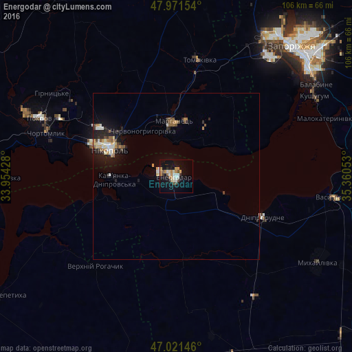
Analysis of Energodar night lights 2016
Square area 10x10 km:
 3.41%
3.41%90-99
2.98%80-89
1.99%70-79
5.54%60-69
1.14%50-59
1.14%40-49
2.27%30-39
1.14%20-29
0.57%10-19
23.72%0-9
56.11%Square area 50x50 km:
0.43%90-99
0.5%80-89
0.32%70-79
0.53%60-69
0.41%50-59
0.38%40-49
0.35%30-39
0.32%20-29
0.62%10-19
2.88%0-9
93.26%Clear (daylight) street map image can be seen on geolist.org.
Map coordinates:
47° 58' 17.5" North, 33° 57' 15.4" East
47° 29' 55.1" North, 34° 39' 26.6" East
47° 1' 17.3" North, 35° 21' 37.9" East
Some cities around Energodar sort by population:
• Nikopol
21.2 km =13.2 mi,  292°
292°
• Marhanets’
15.4 km =9.6 mi,  351°
351°
• Dniprorudne
27.3 km =17 mi,  118°
118°
• Chervonohryhorivka
16.4 km =10.2 mi,  327°
327°
• Mala Bilozerka
34.9 km =21.7 mi,  143°
143°
• Balky
25.1 km =15.6 mi, 120°
• Vodyane
12.5 km =7.8 mi,  264°
264°
• Vil’ne
19.3 km =12 mi,  37°
37°
709276 (p: 55,800)
Sources (retrieved 2019-11-25):
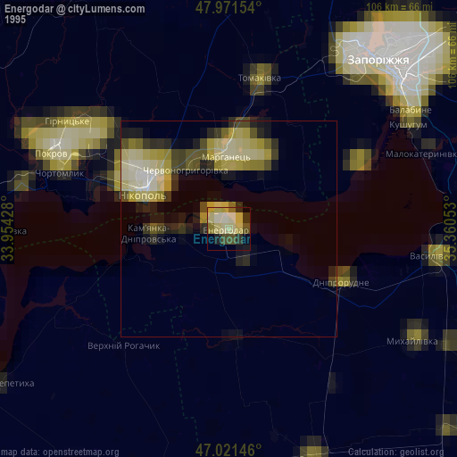
» NASA, Earths city lights 1995
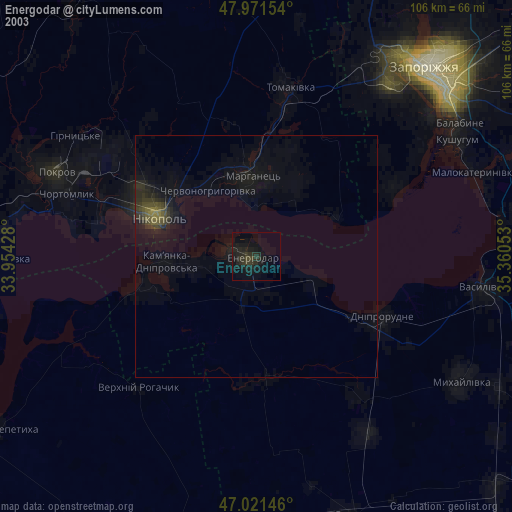
» NASA city lights 2003
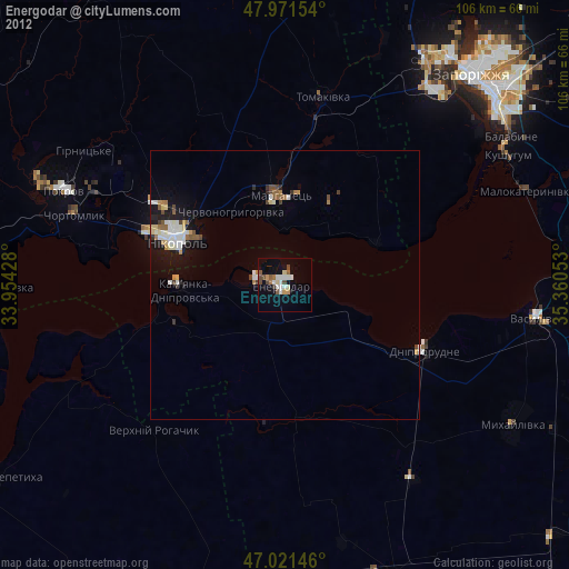
» Earth at Night: Flat Maps 2012, 2016