Slobozhans’ke night lights from space
Night Light of Slobozhans’ke (Kharkiv) from space (Ukraine) Src. Average luminocity for 10x10km area is 3.014% and for 50x50km: 0.6072%.
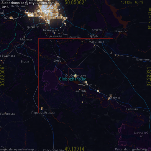
Analysis of Slobozhans’ke night lights 2016
Square area 10x10 km:
 0%
0%90-99
0%80-89
0%70-79
0.7%60-69
0.98%50-59
1.68%40-49
0.14%30-39
0.98%20-29
0.14%10-19
0%0-9
95.38%Square area 50x50 km:
0.02%90-99
0.05%80-89
0.02%70-79
0.11%60-69
0.13%50-59
0.14%40-49
0.13%30-39
0.23%20-29
0.24%10-19
0.09%0-9
98.84%Clear (daylight) street map image can be seen on geolist.org.
Map coordinates:
50° 3' 2.2" North, 35° 49' 23" East
49° 35' 49.2" North, 36° 31' 34.2" East
49° 8' 20.9" North, 37° 13' 45.5" East
Some cities around Slobozhans’ke sort by population:
• Chuhuyiv
29 km =18 mi,  23°
23°
• Balakliya
28.3 km =17.6 mi,  121°
121°
• Pervomays’kyy
32.4 km =20.1 mi,  223°
223°
• Zmiyiv
15.5 km =9.6 mi,  303°
303°
• Bezlyudivka
36.2 km =22.5 mi,  328°
328°
• Malynivka
28.6 km =17.8 mi,  31°
31°
• Vasyshcheve
29.5 km =18.3 mi, 330°
• Eskhar
22.6 km =14 mi,  11°
11°
705183 (p: 15,825)
Sources (retrieved 2019-11-25):
» Earth at Night: Flat Maps 2012, 2016