Chuhuyiv night lights from space
Night Light of Chuhuyiv (Kharkiv) from space (Ukraine) Src. Average luminocity for 10x10km area is 1.4853% and for 50x50km: 1.7714%.
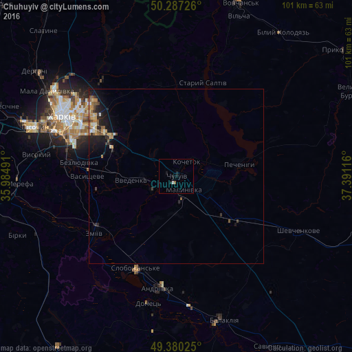
Analysis of Chuhuyiv night lights 2016
Square area 10x10 km:
 0.4%
0.4%90-99
0.13%80-89
0%70-79
0%60-69
0.27%50-59
0.27%40-49
0%30-39
0%20-29
0.67%10-19
2.01%0-9
96.26%Square area 50x50 km:
0.08%90-99
0.23%80-89
0.19%70-79
0.34%60-69
0.31%50-59
0.35%40-49
0.19%30-39
0.24%20-29
0.56%10-19
1.6%0-9
95.92%Clear (daylight) street map image can be seen on geolist.org.
Map coordinates:
50° 17' 14.1" North, 35° 59' 5.7" East
49° 50' 9.2" North, 36° 41' 16.9" East
49° 22' 48.9" North, 37° 23' 28.2" East
Some cities around Chuhuyiv sort by population:
• Kharkiv
35.1 km =21.8 mi,  297°
297°
• Zmiyiv
30.3 km =18.8 mi,  233°
233°
• Slobozhans’ke
29 km =18 mi,  203°
203°
• Pokotylivka
37.8 km =23.5 mi,  283°
283°
• Bezlyudivka
30.6 km =19 mi, 278°
• Malynivka
3.9 km =2.4 mi,  123°
123°
• Vasyshcheve
25.9 km =16.1 mi,  268°
268°
• Eskhar
8.3 km =5.2 mi,  237°
237°
710374 (p: 36,519)
Sources (retrieved 2019-11-25):
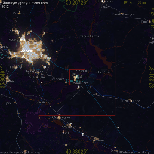
» Earth at Night: Flat Maps 2012, 2016