Slavuta night lights from space
Night Light of Slavuta (Khmelnytskyi) from space (Ukraine) Src. Average luminocity for 10x10km area is 3.2741% and for 50x50km: 0.9527%.
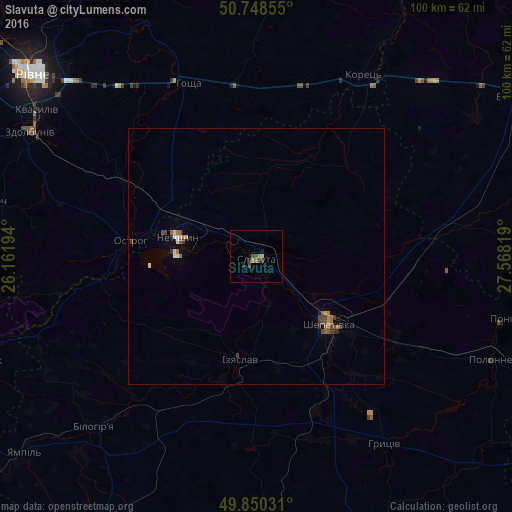
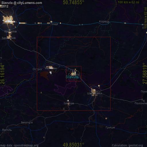
Analysis of Slavuta night lights 2016
Square area 10x10 km:
 0%
0%90-99
0%80-89
0.53%70-79
0%60-69
0.94%50-59
0.67%40-49
1.6%30-39
0.67%20-29
1.47%10-19
1.07%0-9
93.05%Square area 50x50 km:
0.04%90-99
0.11%80-89
0.07%70-79
0.06%60-69
0.27%50-59
0.14%40-49
0.31%30-39
0.2%20-29
0.14%10-19
0.13%0-9
98.55%Clear (daylight) street map image can be seen on geolist.org.
Map coordinates:
50° 44' 54.8" North, 26° 9' 43" East
50° 18' 5.6" North, 26° 51' 54.2" East
49° 51' 1.1" North, 27° 34' 5.5" East
Some cities around Slavuta sort by population:
• Shepetivka
19.1 km =11.9 mi,  132°
132°
• Netishyn
16.4 km =10.2 mi,  285°
285°
• Polonne
50 km =31.1 mi,  113°
113°
• Izyaslav
20.5 km =12.7 mi,  188°
188°
• Ostroh
25.1 km =15.6 mi,  277°
277°
• Korets
40.8 km =25.4 mi,  30°
30°
• Poninka
49.5 km =30.8 mi, 105°
• Hoshcha
35.9 km =22.3 mi,  337°
337°
693581 (p: 33,080)
Sources (retrieved 2019-11-25):
» Earth at Night: Flat Maps 2012, 2016