Kaniv night lights from space
Night Light of Kaniv (Cherkasy) from space (Ukraine) Src. Average luminocity for 10x10km area is 1.4412% and for 50x50km: 0.1054%.
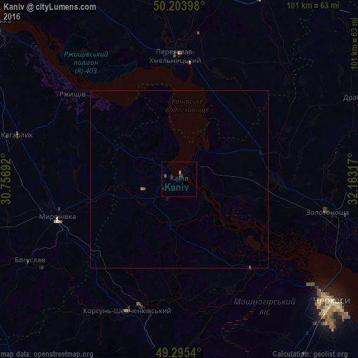
Analysis of Kaniv night lights 2016
Square area 10x10 km:
 0%
0%90-99
0%80-89
0%70-79
0.4%60-69
0.13%50-59
0.53%40-49
0%30-39
0.8%20-29
0.8%10-19
0.53%0-9
96.79%Square area 50x50 km:
0%90-99
0%80-89
0.01%70-79
0.03%60-69
0.02%50-59
0.04%40-49
0%30-39
0.03%20-29
0.03%10-19
0.07%0-9
99.77%Clear (daylight) street map image can be seen on geolist.org.
Map coordinates:
50° 12' 14.3" North, 30° 45' 24.9" East
49° 45' 6.6" North, 31° 27' 36.1" East
49° 17' 43.4" North, 32° 9' 47.4" East
Some cities around Kaniv sort by population:
• Pereiaslav-Khmelnytskyi
35.1 km =21.8 mi,  358°
358°
• Zolotonosha
42.8 km =26.6 mi,  102°
102°
• Korsun-Shevchenkivskyi
39.8 km =24.7 mi,  201°
201°
• Bohuslav
47.8 km =29.7 mi,  241°
241°
• Kaharlyk
47 km =29.2 mi,  285°
285°
• Myronivka
35.8 km =22.2 mi,  253°
253°
• Rzhyshchiv
38.2 km =23.7 mi,  309°
309°
• Ruska Poliana
49.9 km =31 mi,  138°
138°
706900 (p: 25,666)
Sources (retrieved 2019-11-25):
» Earth at Night: Flat Maps 2012, 2016