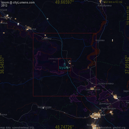
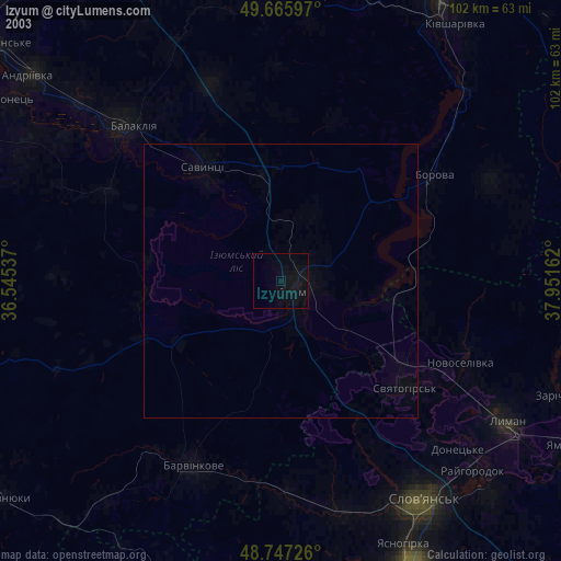
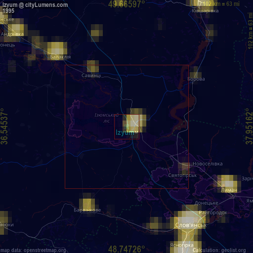
Izyum night lights from space
Night Light of Izyum (Kharkiv) from space (Ukraine) Src. Average luminocity for 10x10km area is 0.6858% and for 50x50km: 0.0418%.
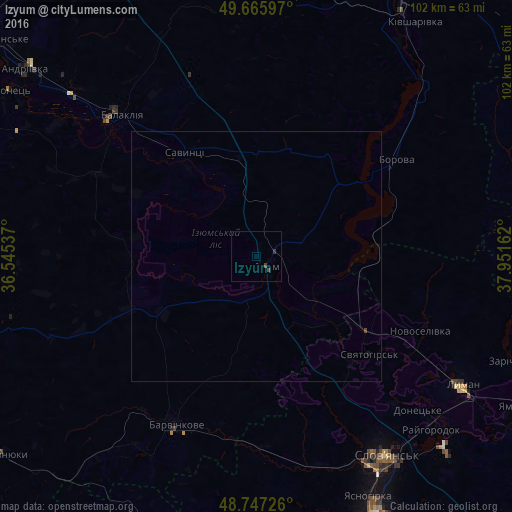
Analysis of Izyum night lights 2016
Square area 10x10 km:
 0%
0%90-99
0%80-89
0%70-79
0%60-69
0%50-59
0%40-49
1.07%30-39
0.53%20-29
0%10-19
0%0-9
98.4%Square area 50x50 km:
0%90-99
0%80-89
0%70-79
0%60-69
0%50-59
0%40-49
0.07%30-39
0.02%20-29
0%10-19
0.02%0-9
99.89%Clear (daylight) street map image can be seen on geolist.org.
Map coordinates:
49° 39' 57.5" North, 36° 32' 43.3" East
49° 12' 31.5" North, 37° 14' 54.6" East
48° 44' 50.1" North, 37° 57' 5.8" East
Some cities around Izyum sort by population:
• Sloviansk
46.6 km =29 mi,  144°
144°
• Balakliya
39.9 km =24.8 mi,  315°
315°
• Lyman
47.2 km =29.3 mi,  121°
121°
• Kivsharivka
56.7 km =35.2 mi,  34°
34°
• Barvinkove
37.2 km =23.1 mi,  206°
206°
• Shevchenkove
54.4 km =33.8 mi,  354°
354°
• Borova
32.9 km =20.4 mi,  55°
55°
• Savyntsi
25.4 km =15.8 mi,  327°
327°
707292 (p: 53,778)
Sources (retrieved 2019-11-25):
» NASA, Earths city lights 1995
» NASA city lights 2003
» Earth at Night: Flat Maps 2012, 2016