Barvinkove night lights from space
Night Light of Barvinkove (Kharkiv) from space (Ukraine) Src. Average luminocity for 10x10km area is 1.2429% and for 50x50km: 0.0494%.
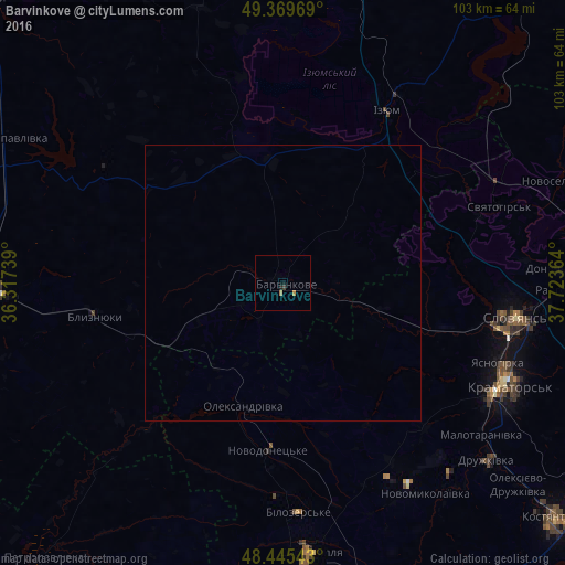
Analysis of Barvinkove night lights 2016
Square area 10x10 km:
 0%
0%90-99
0%80-89
0%70-79
0.28%60-69
0.85%50-59
0%40-49
0%30-39
0.57%20-29
0.28%10-19
0.28%0-9
97.73%Square area 50x50 km:
0%90-99
0%80-89
0%70-79
0.01%60-69
0.03%50-59
0%40-49
0%30-39
0.02%20-29
0.01%10-19
0.01%0-9
99.91%Clear (daylight) street map image can be seen on geolist.org.
Map coordinates:
49° 22' 10.9" North, 36° 19' 2.6" East
48° 54' 34.9" North, 37° 1' 13.8" East
48° 26' 43.5" North, 37° 43' 25.1" East
Some cities around Barvinkove sort by population:
• Kramators’k
44.4 km =27.6 mi,  117°
117°
• Sloviansk
43.8 km =27.2 mi,  96°
96°
• Druzhkivka
49.9 km =31 mi,  128°
128°
• Lozova
51.4 km =31.9 mi,  267°
267°
• Izyum
37.2 km =23.1 mi,  26°
26°
• Dobropillya
50.1 km =31.1 mi,  174°
174°
• Panyutyne
54.5 km =33.9 mi, 273°
• Novodonets’ke
30.6 km =19 mi,  184°
184°
712794 (p: 12,344)
Sources (retrieved 2019-11-25):
» Earth at Night: Flat Maps 2012, 2016