Dykan’ka night lights from space
Night Light of Dykan’ka (Poltava) from space (Ukraine) Src. Average luminocity for 10x10km area is 0% and for 50x50km: 0.612%.
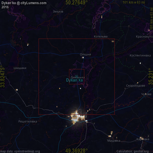
Analysis of Dykan’ka night lights 2016
Square area 10x10 km:
 0%
0%90-99
0%80-89
0%70-79
0%60-69
0%50-59
0%40-49
0%30-39
0%20-29
0%10-19
0%0-9
100%Square area 50x50 km:
0.08%90-99
0.06%80-89
0.04%70-79
0.05%60-69
0.09%50-59
0.09%40-49
0.06%30-39
0.03%20-29
0.21%10-19
0.86%0-9
98.44%Clear (daylight) street map image can be seen on geolist.org.
Map coordinates:
50° 16' 35.4" North, 33° 49' 29.1" East
49° 49' 30" North, 34° 31' 40.3" East
49° 22' 9.4" North, 35° 13' 51.6" East
Some cities around Dykan’ka sort by population:
• Poltava
25.7 km =16 mi,  177°
177°
• Kotel’va
31.7 km =19.7 mi,  31°
31°
• Zin’kiv
44.2 km =27.5 mi,  344°
344°
• Reshetylivka
43.4 km =27 mi,  228°
228°
• Krasnokuts’k
52.7 km =32.7 mi,  59°
59°
• Chutove
47.5 km =29.5 mi,  105°
105°
• Oposhnya
15.8 km =9.8 mi,  22°
22°
• Shyshaky
37.6 km =23.4 mi,  279°
279°
710041 (p: 8,000)
Sources (retrieved 2019-11-25):
» Earth at Night: Flat Maps 2012, 2016