Chornomors’k night lights from space
Night Light of Chornomors’k (Odesa) from space (Ukraine) Src. Average luminocity for 10x10km area is 38.0372% and for 50x50km: 10.5737%.
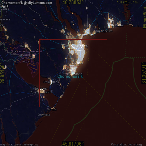
Analysis of Chornomors’k night lights 2016
Square area 10x10 km:
 11.31%
90-99
9.52%80-89
0.89%70-79
2.68%60-69
2.83%50-59
2.53%40-49
3.27%30-39
3.42%20-29
15.63%10-19
28.27%0-9
19.64%Square area 50x50 km:
2.8%90-99
2.33%80-89
0.56%70-79
0.87%60-69
1.08%50-59
1.17%40-49
1.37%30-39
1.63%20-29
3.08%10-19
4.37%0-9
80.75%Clear (daylight) street map image can be seen on geolist.org.
Map coordinates:
46° 47' 18.7" North, 29° 57' 6" East
46° 18' 17.8" North, 30° 39' 17.2" East
45° 49' 1.4" North, 31° 21' 28.5" East
Some cities around Chornomors’k sort by population:
• Odessa
20.1 km =12.5 mi,  17°
17°
• Bilhorod-Dnistrovskyi
26.5 km =16.5 mi,  242°
242°
• Ovidiopol
17.5 km =10.9 mi,  249°
249°
• Teplodar
33.7 km =20.9 mi,  311°
311°
• Usatove
25.4 km =15.8 mi,  0°
0°
• Shabo
28.2 km =17.5 mi,  227°
227°
• Fontanka
33 km =20.5 mi,  28°
28°
• Mayaky
31.8 km =19.8 mi,  293°
293°
707688 (p: 54,102)
Sources (retrieved 2019-11-25):
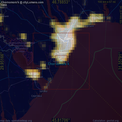
» NASA, Earths city lights 1995
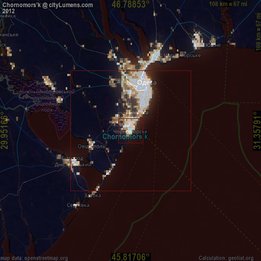
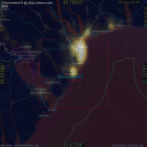
» NASA city lights 2003
» Earth at Night: Flat Maps 2012, 2016