Ovidiopol night lights from space
Night Light of Ovidiopol (Odesa) from space (Ukraine) Src. Average luminocity for 10x10km area is 7.5089% and for 50x50km: 8.0147%.
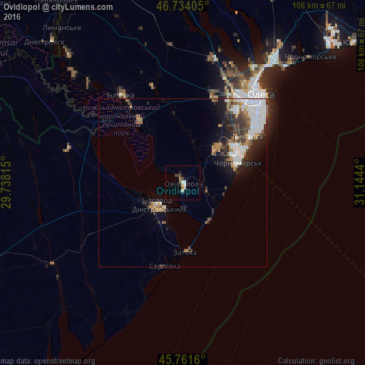
Analysis of Ovidiopol night lights 2016
Square area 10x10 km:
 0.3%
0.3%90-99
2.68%80-89
0%70-79
0.74%60-69
1.04%50-59
0.6%40-49
1.34%30-39
1.04%20-29
1.19%10-19
0.6%0-9
90.48%Square area 50x50 km:
2.1%90-99
1.63%80-89
0.31%70-79
0.69%60-69
0.96%50-59
1.01%40-49
1.18%30-39
1.19%20-29
2.14%10-19
3.01%0-9
85.79%Clear (daylight) street map image can be seen on geolist.org.
Map coordinates:
46° 44' 2.6" North, 29° 44' 17.3" East
46° 14' 59.9" North, 30° 26' 28.6" East
45° 45' 41.8" North, 31° 8' 39.8" East
Some cities around Ovidiopol sort by population:
• Odessa
33.8 km =21 mi,  41°
41°
• Chornomors’k
17.5 km =10.9 mi,  69°
69°
• Bilhorod-Dnistrovskyi
9.3 km =5.8 mi,  229°
229°
• Bilyayivka
31.1 km =19.3 mi,  326°
326°
• Teplodar
29.8 km =18.5 mi,  342°
342°
• Shabo
13.7 km =8.5 mi,  198°
198°
• Mayaky
22.6 km =14 mi, 325°
• Serhiyivka
25.3 km =15.7 mi,  191°
191°
698138 (p: 11,818)
Sources (retrieved 2019-11-25):
» Earth at Night: Flat Maps 2012, 2016