Shabo night lights from space
Night Light of Shabo (Odesa) from space (Ukraine) Src. Average luminocity for 10x10km area is 3.7813% and for 50x50km: 3.0996%.
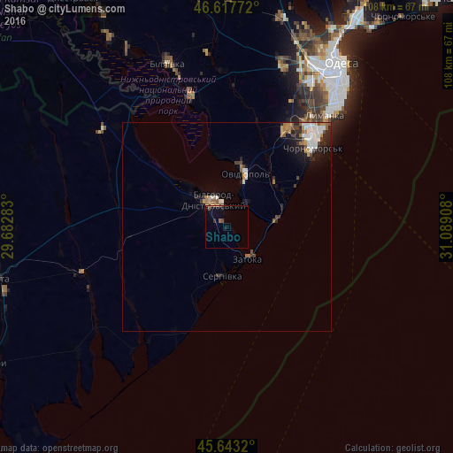
Analysis of Shabo night lights 2016
Square area 10x10 km:
 0%
0%90-99
0%80-89
0%70-79
0.43%60-69
0.43%50-59
1.42%40-49
1.42%30-39
0.28%20-29
0.99%10-19
1.14%0-9
93.89%Square area 50x50 km:
0.56%90-99
0.58%80-89
0.1%70-79
0.35%60-69
0.5%50-59
0.47%40-49
0.37%30-39
0.32%20-29
0.93%10-19
1.41%0-9
94.4%Clear (daylight) street map image can be seen on geolist.org.
Map coordinates:
46° 37' 3.8" North, 29° 40' 58.2" East
46° 7' 57.4" North, 30° 23' 9.4" East
45° 38' 35.5" North, 31° 5' 20.7" East
Some cities around Shabo sort by population:
• Chornomors’k
28.2 km =17.5 mi,  47°
47°
• Bilhorod-Dnistrovskyi
7.5 km =4.7 mi,  337°
337°
• Bilyayivka
41.1 km =25.5 mi, 341°
• Ovidiopol
13.7 km =8.5 mi,  18°
18°
• Teplodar
41.8 km =26 mi,  353°
353°
• Mayaky
32.8 km =20.4 mi, 344°
• Starokozache
38.3 km =23.8 mi,  306°
306°
• Serhiyivka
11.7 km =7.3 mi,  183°
183°
694392 (p: 6,886)
Sources (retrieved 2019-11-25):
» Earth at Night: Flat Maps 2012, 2016