Teplodar night lights from space
Night Light of Teplodar (Odesa) from space (Ukraine) Src. Average luminocity for 10x10km area is 2.0313% and for 50x50km: 4.7962%.
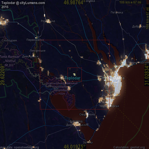
Analysis of Teplodar night lights 2016
Square area 10x10 km:
 0%
0%90-99
0%80-89
0.28%70-79
0.85%60-69
0%50-59
0.57%40-49
0%30-39
0%20-29
1.42%10-19
0%0-9
96.88%Square area 50x50 km:
0.42%90-99
0.52%80-89
0.36%70-79
0.48%60-69
0.89%50-59
1.1%40-49
1.15%30-39
0.88%20-29
1.9%10-19
2.66%0-9
89.63%Clear (daylight) street map image can be seen on geolist.org.
Map coordinates:
46° 59' 15.5" North, 29° 37' 19.5" East
46° 30' 21.1" North, 30° 19' 30.8" East
46° 1' 11.1" North, 31° 1' 42" East
Some cities around Teplodar sort by population:
• Odessa
31.3 km =19.4 mi,  95°
95°
• Bilyayivka
8.7 km =5.4 mi,  253°
253°
• Ovidiopol
29.8 km =18.5 mi,  162°
162°
• Dnestrovsc, MD
33.4 km =20.8 mi,  291°
291°
• Lymanske
32 km =19.9 mi,  301°
301°
• Usatove
25.8 km =16 mi,  83°
83°
• Mayaky
10.6 km =6.6 mi,  201°
201°
• Starokozache
32.1 km =19.9 mi,  234°
234°
865087 (p: 8,502)
Sources (retrieved 2019-11-25):
» Earth at Night: Flat Maps 2012, 2016