Chabany night lights from space
Night Light of Chabany (Kyiv) from space (Ukraine) Src. Average luminocity for 10x10km area is 46.3011% and for 50x50km: 26.8673%.
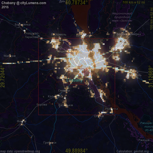
Analysis of Chabany night lights 2016
Square area 10x10 km:
 6.86%
6.86%90-99
8.82%80-89
2.66%70-79
3.36%60-69
5.04%50-59
12.04%40-49
17.09%30-39
5.88%20-29
12.32%10-19
24.51%0-9
1.4%Square area 50x50 km:
6.84%90-99
5.49%80-89
2.09%70-79
2.74%60-69
2.94%50-59
2.95%40-49
3.19%30-39
3.84%20-29
6.7%10-19
13.84%0-9
49.38%Clear (daylight) street map image can be seen on geolist.org.
Map coordinates:
50° 47' 14.4" North, 29° 43' 13.6" East
50° 20' 26.6" North, 30° 25' 24.8" East
49° 53' 23.4" North, 31° 7' 36.1" East
Some cities around Chabany sort by population:
• Kyiv
14.5 km =9 mi,  29°
29°
• Vasylkiv
18.8 km =11.7 mi,  204°
204°
• Boyarka
9.3 km =5.8 mi,  255°
255°
• Vyshneve
6.6 km =4.1 mi,  325°
325°
• Kotsyubyns’ke
17.7 km =11 mi,  337°
337°
• Hlevakha
10.1 km =6.3 mi,  222°
222°
• Sofiyivska Borschagivka
8.7 km =5.4 mi, 332°
• Hnidyn
20.4 km =12.7 mi,  93°
93°
8519952 (p: 7,650)
Sources (retrieved 2019-11-25):
» Earth at Night: Flat Maps 2012, 2016