Boyarka night lights from space
Night Light of Boyarka (Kyiv) from space (Ukraine) Src. Average luminocity for 10x10km area is 21.7634% and for 50x50km: 21.9986%.
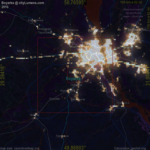
Analysis of Boyarka night lights 2016
Square area 10x10 km:
 0.53%
0.53%90-99
1.47%80-89
2.27%70-79
1.6%60-69
5.21%50-59
4.68%40-49
2.81%30-39
4.01%20-29
11.36%10-19
27.14%0-9
38.9%Square area 50x50 km:
6.27%90-99
4.67%80-89
1.66%70-79
2.22%60-69
2.35%50-59
2.46%40-49
2.64%30-39
3.01%20-29
4.41%10-19
8.82%0-9
61.49%Clear (daylight) street map image can be seen on geolist.org.
Map coordinates:
50° 45' 57.4" North, 29° 35' 39" East
50° 19' 8.8" North, 30° 17' 50.2" East
49° 52' 4.9" North, 31° 0' 1.5" East
Some cities around Boyarka sort by population:
• Kyiv
22 km =13.7 mi,  46°
46°
• Vasylkiv
14.7 km =9.1 mi,  175°
175°
• Vyshneve
9.4 km =5.8 mi,  33°
33°
• Kotsyubyns’ke
19 km =11.8 mi,  6°
6°
• Hlevakha
5.4 km =3.4 mi,  157°
157°
• Chabany
9.3 km =5.8 mi,  75°
75°
• Borova
21 km =13 mi,  220°
220°
• Sofiyivska Borschagivka
11.3 km =7 mi, 26°
711515 (p: 34,631)
Sources (retrieved 2019-11-25):
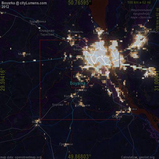
» Earth at Night: Flat Maps 2012, 2016