Ngerengere night lights from space
Night Light of Ngerengere (Morogoro) from space (Tanzania) Src. Average luminocity for 10x10km area is 0.3636% and for 50x50km: 0.0498%.
Analysis of Ngerengere night lights 2016
Square area 10x10 km:
 0%
0%90-99
0%80-89
0%70-79
0%60-69
0%50-59
0%40-49
0%30-39
0.87%20-29
0%10-19
0%0-9
99.13%Square area 50x50 km:
0%90-99
0%80-89
0%70-79
0%60-69
0%50-59
0%40-49
0.03%30-39
0.03%20-29
0.05%10-19
0%0-9
99.88%Clear (daylight) street map image can be seen on geolist.org.
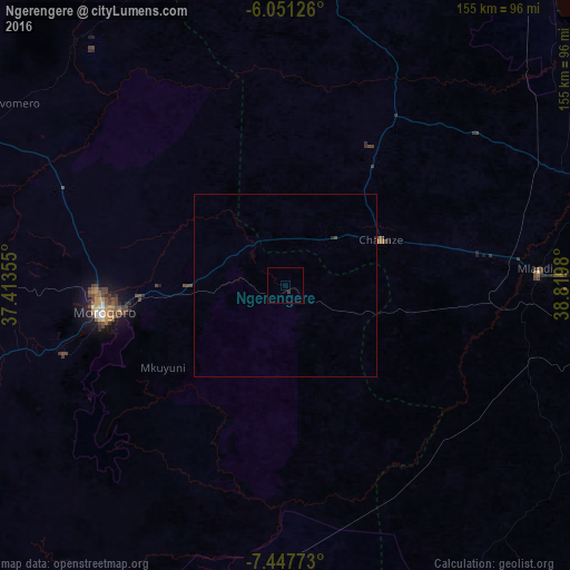
Map coordinates:
6° 3' 4.5" South, 37° 24' 48.8" East
6° 45' 0" South, 38° 7' 0" East
7° 26' 51.8" South, 38° 49' 11.3" East
Some cities around Ngerengere sort by population:
• Morogoro
50.9 km =31.6 mi,  261°
261°
• Chalinze
29 km =18 mi,  64°
64°
• Mvomero
82.4 km =51.2 mi,  47°
47°
• Mlandizi
68.3 km =42.4 mi,  85°
85°
• Kibaha
88.4 km =54.9 mi, 91°
• Lugoba
41.1 km =25.5 mi,  35°
35°
• Kisanga
88.9 km =55.2 mi,  210°
210°
• Maneromango
89 km =55.3 mi,  124°
124°
151678 (p: 17,181)
Sources (retrieved 2019-11-25):
» Earth at Night: Flat Maps 2012, 2016