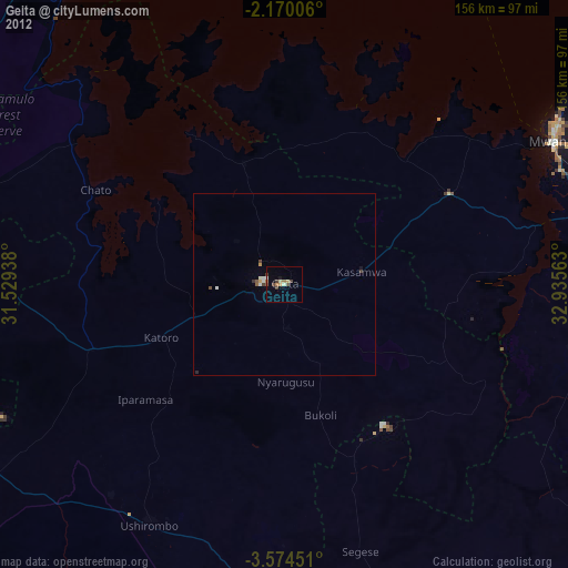
Geita night lights from space
Night Light of Geita from space (Tanzania) Src. Average luminocity for 10x10km area is 22.6017% and for 50x50km: 1.3479%.
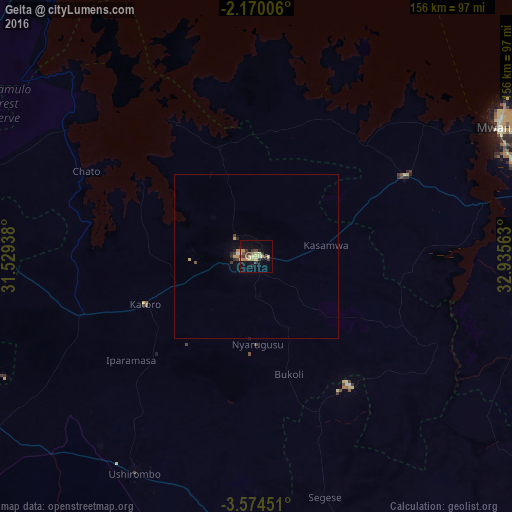
Analysis of Geita night lights 2016
Square area 10x10 km:
100  0.65%
0.65%
90-99 0.22%
80-89 8.01%
70-79 4.76%
60-69 1.95%
50-59 2.16%
40-49 3.25%
30-39 6.06%
20-29 2.6%
10-19 16.23%
0-9 54.11%
0.65%90-99
0.22%80-89
8.01%70-79
4.76%60-69
1.95%50-59
2.16%40-49
3.25%30-39
6.06%20-29
2.6%10-19
16.23%0-9
54.11%Square area 50x50 km:
100 0.03%
90-99 0.03%
80-89 0.38%
70-79 0.3%
60-69 0.08%
50-59 0.12%
40-49 0.21%
30-39 0.35%
20-29 0.2%
10-19 0.79%
0-9 97.51%
0.03%90-99
0.03%80-89
0.38%70-79
0.3%60-69
0.08%50-59
0.12%40-49
0.21%30-39
0.35%20-29
0.2%10-19
0.79%0-9
97.51%Clear (daylight) street map image can be seen on geolist.org.
Map coordinates:
2° 10' 12.2" South, 31° 31' 45.8" East
2° 52' 21" South, 32° 13' 57" East
3° 34' 28.2" South, 32° 56' 8.3" East
Some cities around Geita sort by population:
• Mwanza
84 km =52.2 mi,  61°
61°
• Ushirombo
75.1 km =46.7 mi,  203°
203°
• Buseresere
43.1 km =26.8 mi,  247°
247°
• Katoro
40.8 km =25.4 mi, 246°
• Masumbwe
84.8 km =52.7 mi,  183°
183°
• Chato
57.9 km =36 mi,  296°
296°
• Kasamwa
22.4 km =13.9 mi,  83°
83°
• Mhango
82.4 km =51.2 mi,  123°
123°
159908 (p: 40,000)
Sources (retrieved 2019-11-25):
» Earth at Night: Flat Maps 2012, 2016