Kasamwa night lights from space
Night Light of Kasamwa (Geita) from space (Tanzania) Src. Average luminocity for 10x10km area is 0% and for 50x50km: 0.8332%.
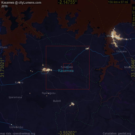
Analysis of Kasamwa night lights 2016
Square area 10x10 km:
100  0%
0%
90-99 0%
80-89 0%
70-79 0%
60-69 0%
50-59 0%
40-49 0%
30-39 0%
20-29 0%
10-19 0%
0-9 100%
0%90-99
0%80-89
0%70-79
0%60-69
0%50-59
0%40-49
0%30-39
0%20-29
0%10-19
0%0-9
100%Square area 50x50 km:
100 0%
90-99 0%
80-89 0.29%
70-79 0.17%
60-69 0.04%
50-59 0.05%
40-49 0.15%
30-39 0.31%
20-29 0.15%
10-19 0.44%
0-9 98.4%
0%90-99
0%80-89
0.29%70-79
0.17%60-69
0.04%50-59
0.05%40-49
0.15%30-39
0.31%20-29
0.15%10-19
0.44%0-9
98.4%Clear (daylight) street map image can be seen on geolist.org.
Map coordinates:
2° 8' 51.2" South, 31° 43' 48.8" East
2° 51' 0" South, 32° 25' 60" East
3° 33' 7.3" South, 33° 8' 11.3" East
Some cities around Kasamwa sort by population:
• Mwanza
63.7 km =39.6 mi,  54°
54°
• Buseresere
65 km =40.4 mi,  252°
252°
• Katoro
62.6 km =38.9 mi, 252°
• Geita
22.4 km =13.9 mi,  263°
263°
• Misungwi
72.2 km =44.9 mi,  90°
90°
• Mhango
66.8 km =41.5 mi,  136°
136°
• Usagara
65.6 km =40.8 mi,  73°
73°
• Misasi
74.1 km =46 mi,  103°
103°
158289 (p: 27,681)
Sources (retrieved 2019-11-25):
» Earth at Night: Flat Maps 2012, 2016