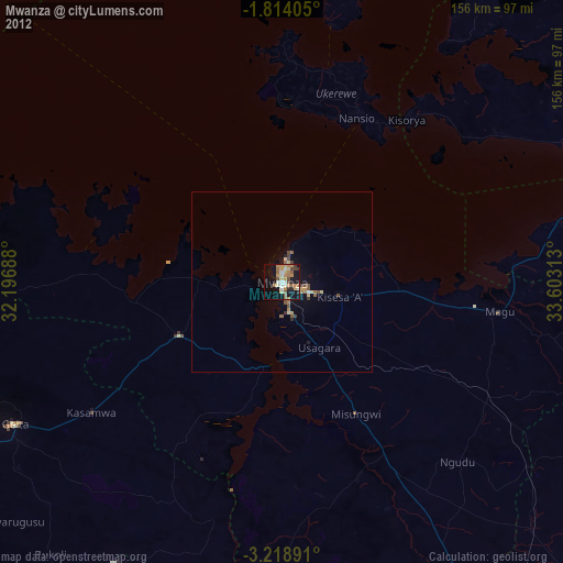
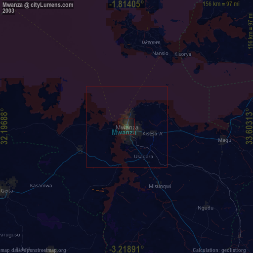
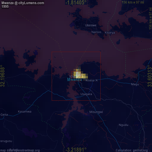
Mwanza night lights from space
Night Light of Mwanza from space (Tanzania) Src. Average luminocity for 10x10km area is 43.2987% and for 50x50km: 4.1781%.
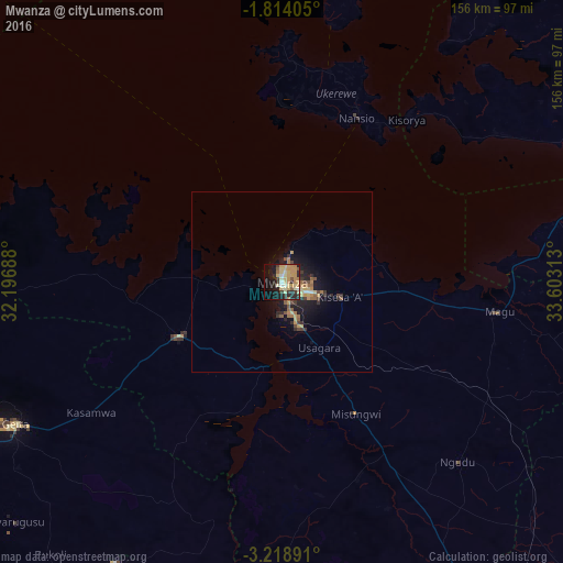
Analysis of Mwanza night lights 2016
Square area 10x10 km:
 1.73%
1.73%90-99
3.46%80-89
16.45%70-79
13.42%60-69
4.98%50-59
3.46%40-49
0.87%30-39
6.71%20-29
9.96%10-19
24.24%0-9
14.72%Square area 50x50 km:
0.12%90-99
0.19%80-89
1%70-79
0.93%60-69
0.58%50-59
0.61%40-49
0.5%30-39
0.67%20-29
1.16%10-19
3.82%0-9
90.42%Clear (daylight) street map image can be seen on geolist.org.
Map coordinates:
1° 48' 50.6" South, 32° 11' 48.8" East
2° 31' 0" South, 32° 54' 0" East
3° 13' 8.1" South, 33° 36' 11.3" East
Some cities around Mwanza sort by population:
• Misungwi
42.3 km =26.3 mi,  151°
151°
• Muriti
59.3 km =36.8 mi,  1°
1°
• Kihangara
50.5 km =31.4 mi,  98°
98°
• Usagara
21.6 km =13.4 mi, 149°
• Misasi
57.5 km =35.7 mi,  159°
159°
• Nyanguge
33.5 km =20.8 mi, 96°
• Nansio
45.8 km =28.5 mi,  21°
21°
• Nakatunguru
48.2 km =30 mi, 22°
152224 (p: 436,801)
Sources (retrieved 2019-11-25):
» NASA, Earths city lights 1995
» NASA city lights 2003
» Earth at Night: Flat Maps 2012, 2016