Sancaktepe night lights from space
Night Light of Sancaktepe (Istanbul) from space (Turkey) Src. Average luminocity for 10x10km area is 88.7228% and for 50x50km: 42.2863%.
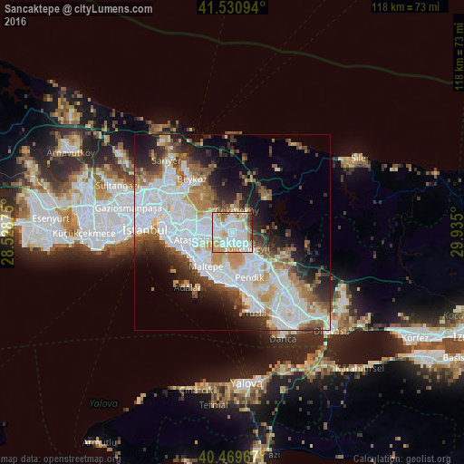
Analysis of Sancaktepe night lights 2016
Square area 10x10 km:
 35.03%
90-99
29.76%80-89
8.67%70-79
12.07%60-69
6.8%50-59
3.74%40-49
2.72%30-39
1.02%20-29
0.17%10-19
0%0-9
0%Square area 50x50 km:
14.91%90-99
9.68%80-89
3.14%70-79
4.16%60-69
4.77%50-59
4.64%40-49
3.62%30-39
4.29%20-29
6.61%10-19
8.54%0-9
35.64%Clear (daylight) street map image can be seen on geolist.org.
Map coordinates:
41° 31' 51.4" North, 28° 31' 43.5" East
41° 0' 8.8" North, 29° 13' 54.7" East
40° 28' 10.8" North, 29° 56' 6" East
Some cities around Sancaktepe sort by population:
• Üsküdar
18.4 km =11.4 mi,  277°
277°
• Umraniye
9.1 km =5.7 mi, 279°
• Maltepe
9.8 km =6.1 mi,  220°
220°
• Ataşehir
9.9 km =6.2 mi,  257°
257°
• Şişli
21.5 km =13.4 mi,  287°
287°
• Sultanbeyli
5.7 km =3.5 mi,  144°
144°
• Eminönü
21.7 km =13.5 mi,  274°
274°
• Adalar
17.1 km =10.6 mi,  209°
209°
7628420 (p: 241,000)
Sources (retrieved 2019-11-25):
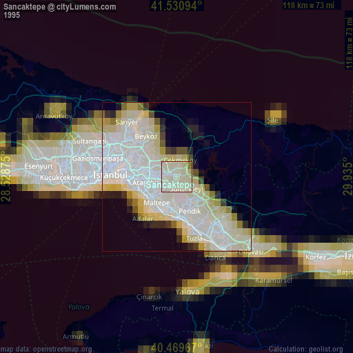
» NASA, Earths city lights 1995
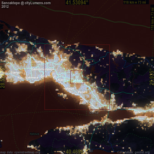
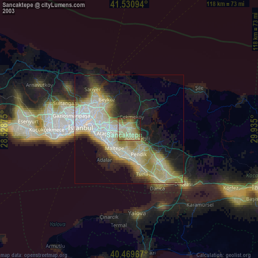
» NASA city lights 2003
» Earth at Night: Flat Maps 2012, 2016