Sultanbeyli night lights from space
Night Light of Sultanbeyli (Istanbul) from space (Turkey) Src. Average luminocity for 10x10km area is 83.085% and for 50x50km: 41.7934%.
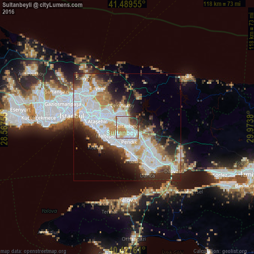
Analysis of Sultanbeyli night lights 2016
Square area 10x10 km:
 32.82%
90-99
23.98%80-89
5.1%70-79
15.14%60-69
7.31%50-59
2.89%40-49
6.8%30-39
4.08%20-29
1.87%10-19
0%0-9
0%Square area 50x50 km:
14.25%90-99
10.04%80-89
3.21%70-79
4.13%60-69
4.73%50-59
4.34%40-49
3.39%30-39
4.32%20-29
7.5%10-19
7.79%0-9
36.3%Clear (daylight) street map image can be seen on geolist.org.
Map coordinates:
41° 29' 22.4" North, 28° 34' 3.2" East
40° 57' 38.6" North, 29° 16' 14.4" East
40° 25' 39.4" North, 29° 58' 25.7" East
Some cities around Sultanbeyli sort by population:
• Üsküdar
22.6 km =14 mi,  287°
287°
• Umraniye
13.7 km =8.5 mi,  296°
296°
• Maltepe
10.1 km =6.3 mi,  253°
253°
• Ataşehir
13.2 km =8.2 mi,  280°
280°
• Gebze
22.1 km =13.7 mi,  142°
142°
• Sancaktepe
5.7 km =3.5 mi,  324°
324°
• Eminönü
25.7 km =16 mi, 284°
• Adalar
15.5 km =9.6 mi,  228°
228°
7628419 (p: 286,622)
Sources (retrieved 2019-11-25):
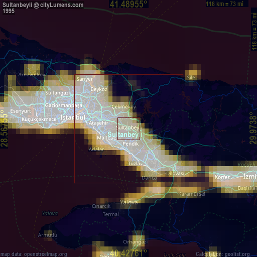
» NASA, Earths city lights 1995
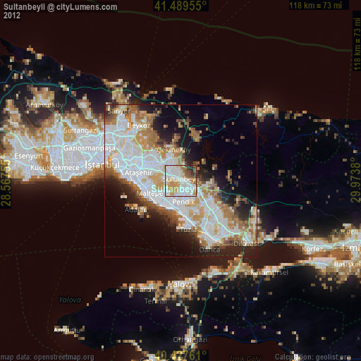
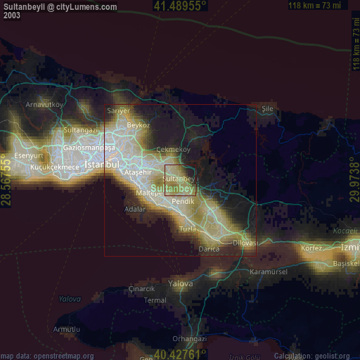
» NASA city lights 2003
» Earth at Night: Flat Maps 2012, 2016