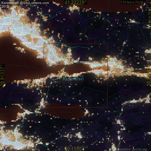
Karamürsel night lights from space
Night Light of Karamürsel (Kocaeli) from space (Turkey) Src. Average luminocity for 10x10km area is 21.4805% and for 50x50km: 25.1306%.
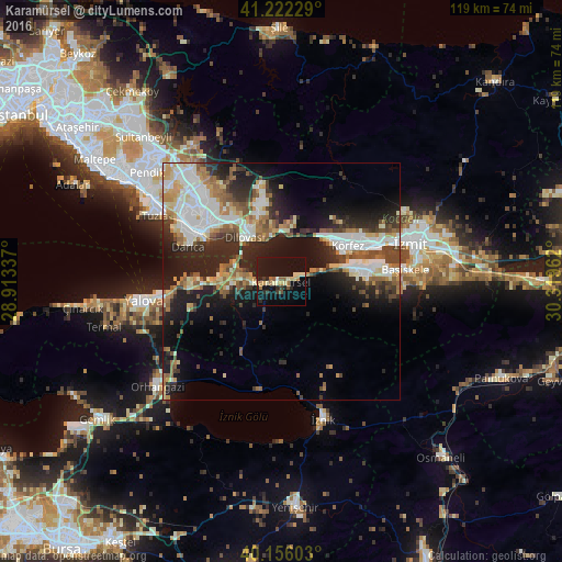
Analysis of Karamürsel night lights 2016
Square area 10x10 km:
 0%
0%90-99
3.25%80-89
4.55%70-79
2.11%60-69
3.08%50-59
2.76%40-49
0.49%30-39
2.92%20-29
4.87%10-19
41.72%0-9
34.25%Square area 50x50 km:
4.96%90-99
5.01%80-89
2.9%70-79
2.39%60-69
3.28%50-59
3.8%40-49
2.95%30-39
3.28%20-29
7.71%10-19
13.43%0-9
50.31%Clear (daylight) street map image can be seen on geolist.org.
Map coordinates:
41° 13' 20.2" North, 28° 54' 48.1" East
40° 41' 28.6" North, 29° 36' 59.4" East
40° 9' 21.7" North, 30° 19' 10.6" East
Some cities around Karamürsel sort by population:
• Gebze
20 km =12.4 mi,  308°
308°
• İzmit
27.6 km =17.1 mi,  72°
72°
• Derince
18.2 km =11.3 mi, 66°
• Körfez
16.3 km =10.1 mi,  58°
58°
• Gölcük
21.6 km =13.4 mi,  86°
86°
• İhsaniye
18.4 km =11.4 mi, 90°
• Bahçecik
25.3 km =15.7 mi,  95°
95°
• Çiftlikköy
24.9 km =15.5 mi,  262°
262°
744168 (p: 30,525)
Sources (retrieved 2019-11-25):
» Earth at Night: Flat Maps 2012, 2016