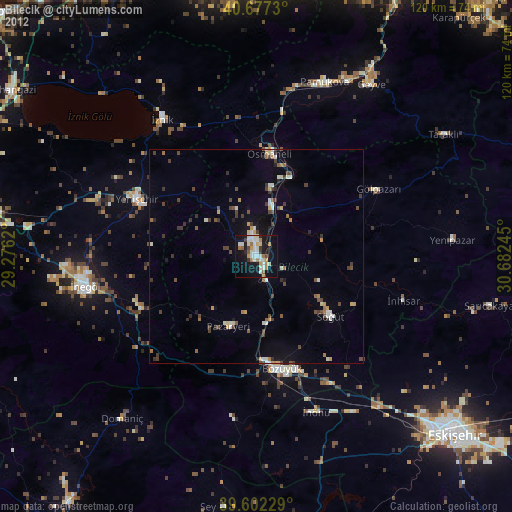
Bilecik night lights from space
Night Light of Bilecik from space (Turkey) Src. Average luminocity for 10x10km area is 32.224% and for 50x50km: 4.8271%.
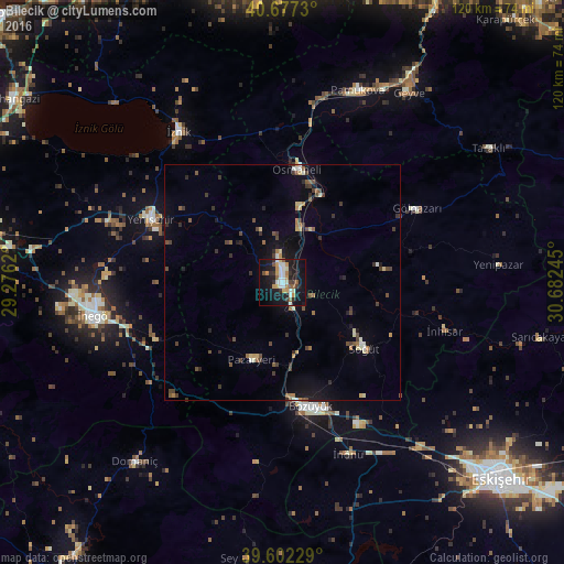
Analysis of Bilecik night lights 2016
Square area 10x10 km:
 6.33%
6.33%90-99
6.01%80-89
2.27%70-79
6.17%60-69
1.62%50-59
3.9%40-49
1.62%30-39
3.73%20-29
6.17%10-19
39.77%0-9
22.4%Square area 50x50 km:
0.38%90-99
0.48%80-89
0.56%70-79
0.52%60-69
0.51%50-59
0.7%40-49
0.88%30-39
1.04%20-29
0.87%10-19
3.35%0-9
90.71%Clear (daylight) street map image can be seen on geolist.org.
Map coordinates:
40° 40' 38.3" North, 29° 16' 34.3" East
40° 8' 30.9" North, 29° 58' 45.6" East
39° 36' 8.2" North, 30° 40' 56.8" East
Some cities around Bilecik sort by population:
• İnegol
40.3 km =25 mi,  259°
259°
• Bozüyük
26.5 km =16.5 mi,  169°
169°
• Yenişehir
30.9 km =19.2 mi,  296°
296°
• İznik
38.7 km =24 mi,  325°
325°
• Osmaneli
24.1 km =15 mi,  7°
7°
• Pamukova
43.7 km =27.2 mi,  21°
21°
• Gölpazarı
32.8 km =20.4 mi,  61°
61°
• Pazaryeri
17.6 km =10.9 mi,  201°
201°
750598 (p: 40,285)
Sources (retrieved 2019-11-25):
» Earth at Night: Flat Maps 2012, 2016