İnegol night lights from space
Night Light of İnegol (Bursa) from space (Turkey) Src. Average luminocity for 10x10km area is 53.0341% and for 50x50km: 8.487%.
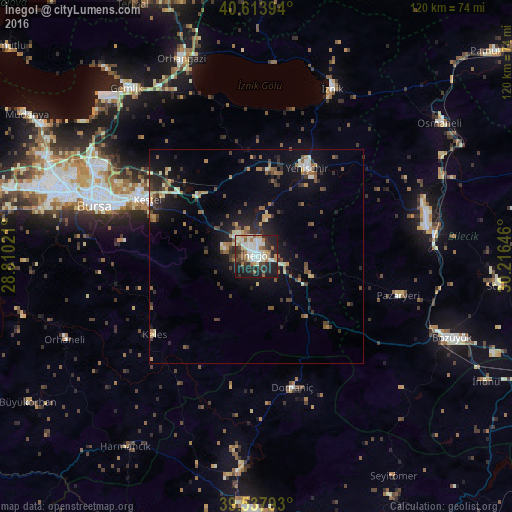

Analysis of İnegol night lights 2016
Square area 10x10 km:
 9.42%
9.42%90-99
16.88%80-89
6.17%70-79
3.73%60-69
6.17%50-59
6.49%40-49
5.36%30-39
4.71%20-29
18.18%10-19
22.56%0-9
0.32%Square area 50x50 km:
0.58%90-99
1.41%80-89
0.78%70-79
0.89%60-69
1.12%50-59
1.39%40-49
1.46%30-39
1.51%20-29
2.81%10-19
6.25%0-9
81.81%Clear (daylight) street map image can be seen on geolist.org.
Map coordinates:
40° 36' 50.2" North, 28° 48' 36.8" East
40° 4' 41" North, 29° 30' 48" East
39° 32' 16.5" North, 30° 12' 59.3" East
Some cities around İnegol sort by population:
• Bursa
40.7 km =25.3 mi,  288°
288°
• Bilecik
40.3 km =25 mi,  79°
79°
• Kestel
28.9 km =18 mi,  297°
297°
• Yenişehir
23.9 km =14.9 mi,  29°
29°
• Gürsu
31.3 km =19.4 mi, 300°
• Pazaryeri
34.6 km =21.5 mi,  105°
105°
• Demirtaş
41.3 km =25.7 mi, 301°
• Domaniç
31.8 km =19.8 mi,  165°
165°
745169 (p: 133,959)
Sources (retrieved 2019-11-25):
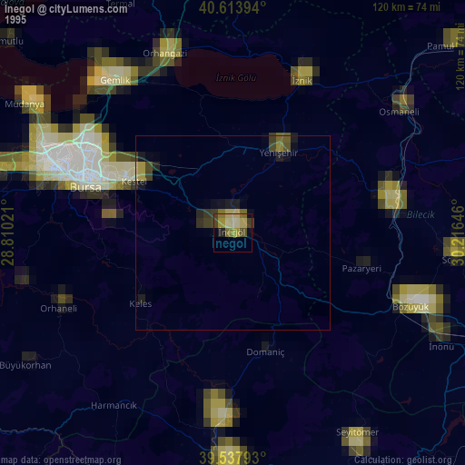
» NASA, Earths city lights 1995
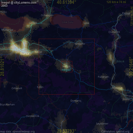
» NASA city lights 2003
» Earth at Night: Flat Maps 2012, 2016