Baskil night lights from space
Night Light of Baskil (Elazığ) from space (Turkey) Src. Average luminocity for 10x10km area is 4.0974% and for 50x50km: 2.3384%.
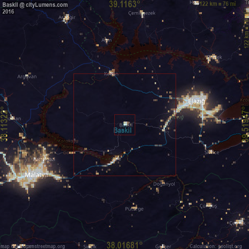
Analysis of Baskil night lights 2016
Square area 10x10 km:
100  0.16%
0.16%
90-99 1.79%
80-89 0.65%
70-79 0%
60-69 0%
50-59 0.65%
40-49 0.65%
30-39 0.65%
20-29 0.65%
10-19 0%
0-9 94.81%
0.16%90-99
1.79%80-89
0.65%70-79
0%60-69
0%50-59
0.65%40-49
0.65%30-39
0.65%20-29
0.65%10-19
0%0-9
94.81%Square area 50x50 km:
100 0.04%
90-99 0.34%
80-89 0.23%
70-79 0.22%
60-69 0.26%
50-59 0.41%
40-49 0.54%
30-39 0.52%
20-29 0.55%
10-19 1.26%
0-9 95.61%
0.04%90-99
0.34%80-89
0.23%70-79
0.22%60-69
0.26%50-59
0.41%40-49
0.54%30-39
0.52%20-29
0.55%10-19
1.26%0-9
95.61%Clear (daylight) street map image can be seen on geolist.org.
Map coordinates:
39° 6' 58.7" North, 38° 6' 47.6" East
38° 34' 7.2" North, 38° 48' 58.8" East
38° 1' 0.5" North, 39° 31' 10.1" East
Some cities around Baskil sort by population:
• Malatya
49.8 km =30.9 mi,  240°
240°
• Elazığ
37.2 km =23.1 mi,  71°
71°
• Pertek
55 km =34.2 mi,  53°
53°
• Doğanyol
34.7 km =21.6 mi,  146°
146°
• Keban
26 km =16.2 mi,  344°
344°
• Sivrice
45.1 km =28 mi,  108°
108°
• Yazıhan
56 km =34.8 mi,  272°
272°
• Çüngüş
57.3 km =35.6 mi,  134°
134°
321929 (p: 15,922)
Sources (retrieved 2019-11-25):
» Earth at Night: Flat Maps 2012, 2016