Ayvalık night lights from space
Night Light of Ayvalık (Balıkesir) from space (Turkey) Src. Average luminocity for 10x10km area is 41.2398% and for 50x50km: 10.178%.
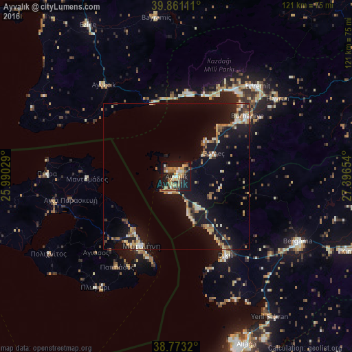
Analysis of Ayvalık night lights 2016
Square area 10x10 km:
 2.21%
2.21%90-99
6.63%80-89
5.78%70-79
7.99%60-69
11.73%50-59
4.08%40-49
4.25%30-39
5.78%20-29
10.37%10-19
38.61%0-9
2.55%Square area 50x50 km:
0.36%90-99
1.7%80-89
1.3%70-79
1.27%60-69
2.18%50-59
0.84%40-49
1.07%30-39
1.28%20-29
1.92%10-19
11.87%0-9
76.22%Clear (daylight) street map image can be seen on geolist.org.
Map coordinates:
39° 51' 40" North, 25° 59' 25" East
39° 19' 9.4" North, 26° 41' 36.3" East
38° 46' 23.5" North, 27° 23' 47.5" East
Some cities around Ayvalık sort by population:
• Bergama
47.4 km =29.5 mi,  117°
117°
• Edremit
41.9 km =26 mi,  42°
42°
• Burhaniye
31.3 km =19.4 mi,  49°
49°
• Mytilene, GR
26.4 km =16.4 mi,  206°
206°
• Dikili
32.4 km =20.1 mi,  148°
148°
• Altınoluk
29.2 km =18.1 mi,  7°
7°
• Havran
43.8 km =27.2 mi, 52°
• Ayvacık
40 km =24.9 mi,  321°
321°
322673 (p: 70,002)
Sources (retrieved 2019-11-25):
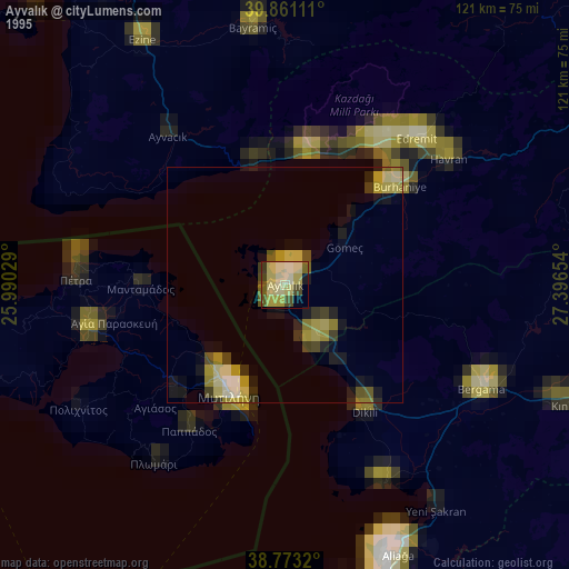
» NASA, Earths city lights 1995
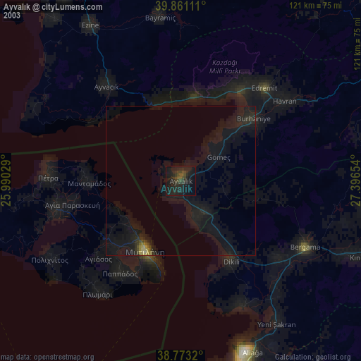
» NASA city lights 2003
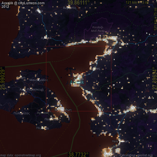
» Earth at Night: Flat Maps 2012, 2016