Mytilene night lights from space
Night Light of Mytilene (North Aegean) from space (Greece) Src. Average luminocity for 10x10km area is 33.3003% and for 50x50km: 6.8946%.
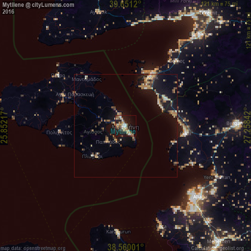
Analysis of Mytilene night lights 2016
Square area 10x10 km:
 1.62%
1.62%90-99
7.79%80-89
5.36%70-79
5.19%60-69
5.52%50-59
2.76%40-49
4.71%30-39
3.73%20-29
6.01%10-19
35.88%0-9
21.43%Square area 50x50 km:
0.15%90-99
1.11%80-89
0.99%70-79
0.85%60-69
1.37%50-59
0.68%40-49
0.79%30-39
1.02%20-29
1.31%10-19
8.11%0-9
83.63%Clear (daylight) street map image can be seen on geolist.org.
Map coordinates:
39° 39' 4.3" North, 25° 51' 7.8" East
39° 6' 27.8" North, 26° 33' 19" East
38° 33' 36" North, 27° 15' 30.3" East
Some cities around Mytilene sort by population:
• Ayvalık, TR
26.4 km =16.4 mi,  26°
26°
• Bergama, TR
54 km =33.6 mi,  88°
88°
• Aliağa, TR
49.7 km =30.9 mi,  133°
133°
• Burhaniye, TR
56.5 km =35.1 mi,  39°
39°
• Foça, TR
51.7 km =32.1 mi,  160°
160°
• Dikili, TR
29.2 km =18.1 mi,  98°
98°
• Altınoluk, TR
54.7 km =34 mi,  16°
16°
• Ayvacık, TR
56.4 km =35 mi,  346°
346°
256866 (p: 28,322)
Sources (retrieved 2019-11-25):
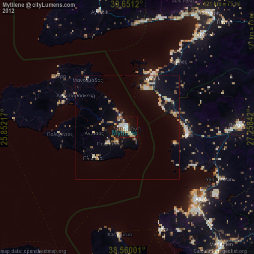
» Earth at Night: Flat Maps 2012, 2016