Monastir night lights from space
Night Light of Monastir (Al Munastīr) from space (Tunisia) Src. Average luminocity for 10x10km area is 30.7133% and for 50x50km: 17.4695%.
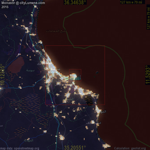

Analysis of Monastir night lights 2016
Square area 10x10 km:
 5.42%
5.42%90-99
5.07%80-89
3.5%70-79
2.62%60-69
3.67%50-59
3.32%40-49
5.24%30-39
6.29%20-29
6.64%10-19
26.92%0-9
31.29%Square area 50x50 km:
2.73%90-99
2.78%80-89
2.45%70-79
1.87%60-69
2.74%50-59
1.44%40-49
2.36%30-39
3.04%20-29
6.72%10-19
11.19%0-9
62.67%Clear (daylight) street map image can be seen on geolist.org.
Map coordinates:
36° 20' 47" North, 10° 7' 23" East
35° 46' 40.8" North, 10° 49' 34.2" East
35° 12' 19.8" North, 11° 31' 45.5" East
Some cities around Monastir sort by population:
• Skanes
2.4 km =1.5 mi,  284°
284°
• Ksar Hellal
15.6 km =9.7 mi,  158°
158°
• Ouardenine
15.7 km =9.8 mi,  240°
240°
• Sahline
10.8 km =6.7 mi,  254°
254°
• Seïada
13.5 km =8.4 mi,  153°
153°
• Banbalah
9 km =5.6 mi,  195°
195°
• Ksibet el Mediouni
10.4 km =6.5 mi,  171°
171°
• Lemta
13.4 km =8.3 mi, 157°
2473493 (p: 71,546)
Sources (retrieved 2019-11-25):
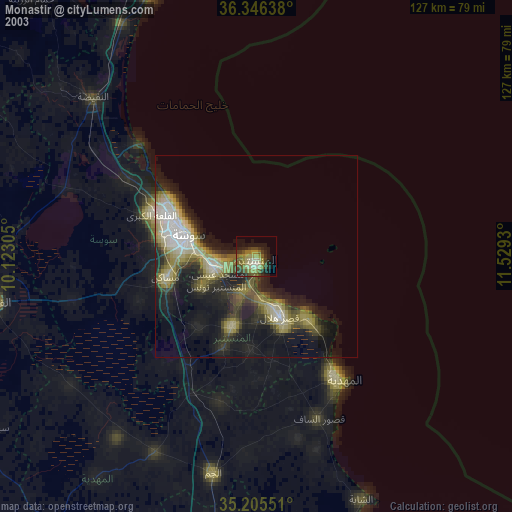
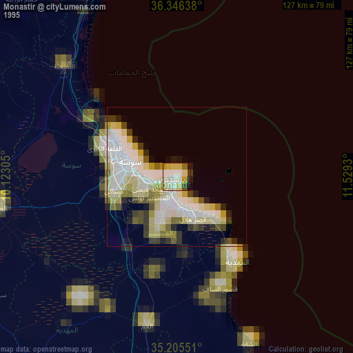
» NASA, Earths city lights 1995
» NASA city lights 2003
» Earth at Night: Flat Maps 2012, 2016